place

Učka Tunnel

Buildings and structures in Istria CountyRoad tunnels in CroatiaToll tunnels in EuropeTunnels completed in 1981
Tunel Učka
Tunel Učka

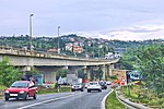
The Učka Tunnel (Croatian: Tunel Učka) is a toll tunnel on the A8 motorway in Croatia, under the Učka mountain range, as part of the Istrian Y network in Istria owned and operated by BINA Istra (owning the highway in a concession from 1995 to 2027). At 9.1 meters (30 ft) wide and 5,062 m (16,608 ft) long, it is the third longest in Croatia after the Mala Kapela and Sveti Rok tunnels. The tunnel consists of a single tube (although another is under construction), with two traffic lanes operating in opposite directions. Construction on the existing tunnel tube began in 1978 and it was opened for traffic on September 27, 1981. The toll is part of the rest of the closed toll collection system in use on the Istrian Y. The shortest possible journey through it costs EUR 4,50 for a class I vehicle. It is rated Class D/E under the ADR treaty for hazardous materials transportation, and vehicles transporting restricted goods must be pre-arranged and escorted. It is the only suitable road between Istria and the rest of Croatia for vehicles over 5 tonnes. In 2022 more than 1.94 million vehicles passed through with AADT of 5,326 and ASDT of 7,361.

Excerpt from the Wikipedia article Učka Tunnel (License: CC BY-SA 3.0, Authors, Images).

Učka Tunnel
Učka Tunnel, Općina Lupoglav

Geographical coordinates (GPS) Address External links Nearby Places
placeShow on map

Wikipedia: Učka TunnelContinue reading on Wikipedia

Geographical coordinates (GPS)

Latitude Longitude
N 45.313333333333 ° E 14.214166666667 °
placeShow on map

Address

Tunel Učka

Učka Tunnel
Općina Lupoglav
Croatia
mapOpen on Google Maps

linkWikiData (Q1288187)
linkOpenStreetMap (143471471)

Tunel Učka
Tunel Učka
Share experience

Nearby Places

Učka
Učka

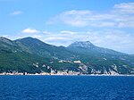
The Učka (Croatian pronunciation: [ûːt͡ʃkaː], Italian: Monte Maggiore) is a mountain range in western Croatia. It rises behind the Opatija riviera, on the eastern side of the Istrian peninsula. It forms a single morphological unit together with the Ćićarija range which stretches from the Bay of Trieste to Rijeka. Učka is a limestone massif with numerous areas of karst, stretching for 20 km from the Poklon Pass (920 m) to Plomin Bay, and is between 4 and 9 km wide. It differs from all the other coastal mountains in Croatia because of its abundant vegetation on the seaward side. Best known are the forests of sweet chestnuts in the area around Lovran. Učka's highest peaks are considered nature reserves and memorial areas. The highest peak, Vojak, is located at 1,396 meters above sea level. It offers views over Istria, the Bay of Trieste, the Julian Alps and the Adriatic islands, right down to Dugi Otok. The subject of a degree of local folklore, Učka is visible from much of the peninsula and is snow-capped some months of the year. The town of Opatija (Italian: Abbazia) is said to have derived its popularity as a resort in Imperial Austria because it is located "in the shade" of Mt. Učka, which by legend shields it from the fierce Mediterranean heat in summertime. The area of Učka is designated as a nature park (park prirode) in Croatia. Historically, the Istro-Romanians, a Romance ethnic group of Istria, have been separated by the mountain range, forming two areas of concentration: one in the village of Žejane and one in the village of Šušnjevica and the surrounding settlements. Although these areas are 50 kilometers away from each other, there is a road around the Učka that connects them.