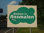
Kruisstraat, 's-Hertogenbosch
's-HertogenboschNorth Brabant geography stubsPages with Dutch IPAPopulated places in North Brabant

Kruisstraat (Dutch pronunciation: [ˈkrœy̯straːt]) is a small Dutch settlement. It is located east of Rosmalen, in the municipality of 's-Hertogenbosch, and the province of North Brabant.
Excerpt from the Wikipedia article Kruisstraat, 's-Hertogenbosch (License: CC BY-SA 3.0, Authors, Images).Kruisstraat, 's-Hertogenbosch
Kruisstraat, 's-Hertogenbosch
Geographical coordinates (GPS) Address Nearby Places Show on map
Geographical coordinates (GPS)
| Latitude | Longitude |
|---|---|
| N 51.731666666667 ° | E 5.3944444444444 ° |
Address
Kruisstraat
Kruisstraat
5249 RH 's-Hertogenbosch
North Brabant, Netherlands
Open on Google Maps


