Terhand
Populated places in West FlandersWest Flanders geography stubs
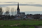
Terhand is a tiny hamlet approximately 12 km east of Ypres in Belgium.The village consists of about 40 houses with a small street running through the middle of them. The road from Ypres is lined with fields but very few trees; most of them were destroyed in the First World War. Terhand was captured by the British Army on 29 September, 1918.
Excerpt from the Wikipedia article Terhand (License: CC BY-SA 3.0, Authors).Terhand
Magerheidstraat,
Geographical coordinates (GPS) Address Nearby Places Show on map
Geographical coordinates (GPS)
| Latitude | Longitude |
|---|---|
| N 50.84 ° | E 3.0597222222222 ° |
Address
Magerheidstraat
Magerheidstraat
8890
West Flanders, Belgium
Open on Google Maps


