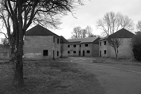
Imber

Imber is an uninhabited village within the British Army's training area on Salisbury Plain, Wiltshire, England. It lies in an isolated area of the Plain, about 2+1⁄2 miles (4 km) west of the A360 road between Tilshead and West Lavington. A linear village, its main street follows the course of a stream. Recorded in the Domesday Book of 1086, Imber was always an isolated community, several miles from any market town, and most of its men worked in agriculture or related trades. Beginning in the 1890s, the Ministry of Defence slowly bought up the village and in 1943 the whole population of about 150 was evicted to provide an exercise area for American troops preparing for the invasion of Europe during the Second World War. After the war, the villagers were not allowed to return to their homes. The area of the former parish, which is now part of the civil parish of Heytesbury, remains under the control of the Ministry of Defence despite several attempts by former residents to return. Non-military access is limited to several open days a year.
Excerpt from the Wikipedia article Imber (License: CC BY-SA 3.0, Authors, Images).Imber
Imber Range Path,
Geographical coordinates (GPS) Address Nearby Places Show on map
Geographical coordinates (GPS)
| Latitude | Longitude |
|---|---|
| N 51.234 ° | E -2.051 ° |
Address
St Giles
Imber Range Path
SN10 5TW , West Lavington
England, United Kingdom
Open on Google Maps


