place

Berwyn Heights, Maryland mayor's residence drug raid

Animal cruelty incidentsBerwyn Heights, MarylandCannabis in MarylandCrimes in MarylandDrug raids
History of drug control in the United StatesNo-knock warrantPolice brutality in the United StatesPrince George's County, MarylandUse mdy dates from April 2022

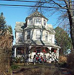
The drug raid at the residence of Cheye Calvo, then-mayor of Berwyn Heights, Maryland, was a controversial action taken by the Prince George's County Sheriff's Office and Police Department on July 29, 2008. The raid was the culmination of an investigation that began in Arizona, where a package containing 32 pounds (15 kg) of marijuana was intercepted in a warehouse, addressed to the mayor's residence. Instead of confiscating the package, police allowed it to be delivered. Upon arrival, a SWAT team raided the house and held Calvo and his mother-in-law at gunpoint, and shot and killed his two dogs, one as it attempted to run away. The event gained national and international media attention. While the Calvos were cleared of wrongdoing, the police were accused by the Calvo family and civil rights groups of lacking a proper search warrant, using excessive force, and failure to conduct a proper background investigation of the home being raided—the investigation was so cursory that the sheriff's office was unaware that Calvo was the mayor. Despite the criticisms, no action has been taken against the officers or their respective police departments. In August 2010, Sheriff Michael A. Jackson stated that: "We've apologized for the incident, but we will never apologize for taking drugs off our streets. Quite frankly, we'd do it again. Tonight."

Excerpt from the Wikipedia article Berwyn Heights, Maryland mayor's residence drug raid (License: CC BY-SA 3.0, Authors).

Berwyn Heights, Maryland mayor's residence drug raid
Edmonston Road, College Park Yarrow

Geographical coordinates (GPS) Address Nearby Places
placeShow on map

Wikipedia: Berwyn Heights, Maryland mayor's residence drug raidContinue reading on Wikipedia

Geographical coordinates (GPS)

Latitude Longitude
N 38.988813888889 ° E -76.907883333333 °
placeShow on map

Address

Edmonston Road 8600
20740 College Park, Yarrow
Maryland, United States
mapOpen on Google Maps

Share experience

Nearby Places

Beltway Plaza Mall

The Beltway Plaza mall is located in Greenbelt, Maryland. It was developed by Sidney J. Brown and First National Realty, opening on October 17, 1963. It was originally composed of a massive S. Klein department store separated by a large parking lot from an A&P Supermarket located in a strip shopping center along with a barbershop, single screen movie theater, and Drug Fair store. By 1972-73, a small indoor mall was created, situated between the strip shopping center and the S. Klein store, that included a 6-screen theater, steakhouse (Emerson's Steakhouse), a branch of George's appliance store chain, an ice cream shop, and in-house catalog store. Within a few years of the S. Klein closing in 1975, the mall underwent major renovations. In the course of renovations, the space occupied by S. Klein was split up to create new spaces for different stores. Small fountains were added. The renovations included an additional 8 screen cinema and a Giant supermarket that was added to one wing of the former shopping strip. The renovation also enclosed the area from the original mall to the supermarket. The mall has 115 stores and restaurants and anchors include a Giant supermarket, Burlington Coat Factory, Marshalls, JoAnn Fabrics, Target, Shoppers World, and TJ Maxx (opened May 2014). (Shoppers World and the former Big Lots replaced a space formerly occupied by Value City until 2010.) The Target cannot be reached from the mall without going outdoors, though it shares a common roof.

Lake Artemesia
Lake Artemesia

Lake Artemesia is a man-made lake in Prince George's County, Maryland, located within the Lake Artemesia Natural Area in College Park and Berwyn Heights. The lake covers an area of 38 acres (150,000 m2), and the surrounding natural area is administered by Maryland-National Capital Park and Planning Commission and includes aquatic gardens, fishing piers, and hiker-biker trails. The lake, located between Indian Creek and Paint Branch, was constructed during the late-1980s completion of the Washington Metro's Green Line, which runs alongside the lake. Sand and gravel were excavated from the site of a smaller lake and the surrounding area to construct the rail beds and parking lots for the College Park–University of Maryland and Greenbelt stations. Metro saved $10 million by sourcing the material locally and in return spent $8 million constructing the lake and natural area to repair the excavation damage. During the construction phase, signs identified the site as "Lake Metro." The park is named for Artemesia N. Drefs, who donated ten lots to the county for preservation as open space in 1972. The smaller lake that existed on the site, which was created in the mid-1800s when stone was quarried from the area for use on the B&O Railroad's Washington Branch line, was already named Lake Artemesia after Artemesia's mother and grandmother, who shared the same name. Drefs's father, Arthur, surveyed the land for his Lakeland development in the 1890s; according to Drefs, the pre-existing lake was originally used to raise goldfish, but was later stocked with bass.The 1.35 mile hiker-biker trail around the lake is part of the Anacostia Tributary Trail System and East Coast Greenway. The site of Lake Artemesia Park was once home to about one third of the Lakeland community, an African-American community which became part of College Park, Maryland in 1945.