Cheadle Coalfield
Cheadle, StaffordshireCoal mining regions in EnglandMining in Staffordshire

The Cheadle Coalfield is a coalfield in the United Kingdom. Centred on the town of Cheadle, Staffordshire and its outlying villages it lies to the east of Stoke-on-Trent and the much larger North Staffordshire Coalfield. The area has been mined for many years, with documentary evidence from Croxden Abbey citing coal mining in the 13th century.Deep mining ceased in 1965 with the closure of Foxfield Colliery by the National Coal Board. Private adit mining and opencast mining ceased in 1994 with the exhaustion of economic reserves.
Excerpt from the Wikipedia article Cheadle Coalfield (License: CC BY-SA 3.0, Authors, Images).Cheadle Coalfield
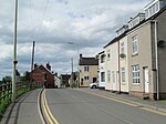
Leek Road, Staffordshire Moorlands
Geographical coordinates (GPS) Address Nearby Places Show on map
Geographical coordinates (GPS)
| Latitude | Longitude |
|---|---|
| N 53 ° | E -2 ° |
Address
Leek Road
Leek Road
ST10 2EH Staffordshire Moorlands
England, United Kingdom
Open on Google Maps


