Tannenbusch
Urban districts and boroughs of Bonn
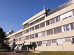
Tannenbusch is a section of Bonn, Germany with approx. 17,000 inhabitants. It is split between the subsections Alt-Tannenbusch and Neu-Tannenbusch. The roads in Tannenbusch are almost exclusively named after places in the former GDR and former eastern territories of Germany (e.g. Schlesienstrasse, Oppelner road, west Prussia route). Around 1949 – 1960 there was a US military camp in Tannenbusch. Of the 15000 inhabitants, 45% have a migrant background. About 40% of the inhabitants in the district live on state welfare payments. An Islamic salafi movement is active in the district.
Excerpt from the Wikipedia article Tannenbusch (License: CC BY-SA 3.0, Authors).Tannenbusch
Stettiner Straße, Bonn Tannenbusch (Stadtbezirk Bonn)
Geographical coordinates (GPS) Address Nearby Places Show on map
Geographical coordinates (GPS)
| Latitude | Longitude |
|---|---|
| N 50.7475 ° | E 7.0575 ° |
Address
Stettiner Straße 3
53119 Bonn, Tannenbusch (Stadtbezirk Bonn)
North Rhine-Westphalia, Germany
Open on Google Maps


