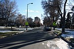
Smith's Irrigation Ditch

Smith's Irrigation Ditch, originally the Big Ditch and also known as the City Ditch is a historic ditch primarily visible in Washington Park, Denver, Colorado. It is listed on the National Register of Historic Places.Denver's first irrigation canal, it was surveyed and built during 1860 to 1867, as an open unlined ditch 3 feet (0.91 m) wide at its bottom, steep sides, and 7 feet (2.1 m) wide at the top. It was dug using horse-drawn plows and scrapers, in addition to manual labor.It runs from the Chatfield Dam through 15 miles (24 km) of Englewood, Colorado, with Englewood taking some of its municipal water supply from it. Denver's Water Department takes control at Harvard Gulch near S. Downing St. and East Harvard Avenue and runs it through an enclosed pipeline, now, for about 8 miles (13 km) to Washington Park, where it remains as an open channel. It sustains trees, flowers, grass there.
Excerpt from the Wikipedia article Smith's Irrigation Ditch (License: CC BY-SA 3.0, Authors, Images).Smith's Irrigation Ditch
South Marion Parkway, Denver
Geographical coordinates (GPS) Address Nearby Places Show on map
Geographical coordinates (GPS)
| Latitude | Longitude |
|---|---|
| N 39.700277777778 ° | E -104.97027777778 ° |
Address
Picnic Site 4
South Marion Parkway
80209 Denver
Colorado, United States
Open on Google Maps


