Anderson Island (Washington)
Islands of Pierce County, WashingtonIslands of Puget SoundIslands of Washington (state)Populated places on Puget SoundUnincorporated communities in Pierce County, Washington ... and 2 more
Unincorporated communities in Washington (state)Use mdy dates from July 2023

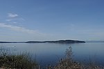
Anderson Island is the southernmost island in Puget Sound and a census-designated place of Pierce County, Washington, United States. It is accessible by boat or a 20-minute ferry ride from Steilacoom. Anderson Island is just south of McNeil Island. To the northwest, Key Peninsula is across Drayton Passage. The south basin of Puget Sound separates the island from the mainland to the southeast, while to the southwest the Nisqually Reach of Puget Sound separates the island from the mainland.
Excerpt from the Wikipedia article Anderson Island (Washington) (License: CC BY-SA 3.0, Authors, Images).Anderson Island (Washington)
Vantage Drive,
Geographical coordinates (GPS) Address Nearby Places Show on map
Geographical coordinates (GPS)
| Latitude | Longitude |
|---|---|
| N 47.16 ° | E -122.71 ° |
Address
Vantage Drive 10713
98303
Washington, United States
Open on Google Maps


