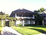
Playhouse District, Pasadena, California
Los Angeles County, California geography stubsNeighborhoods in Pasadena, California

Playhouse Village, (formerly known as Playhouse District) a neighborhood in Pasadena, California, is bordered by Interstate 210 to the north, California Boulevard to the south, Los Robles Avenue to the west, and Hudson Avenue to the east, with a panhandle-like extension to Wilson Avenue. The district is also notable for its manhattanization, the legacy of extensive urbanization from the 1960s to the 1980s.
Excerpt from the Wikipedia article Playhouse District, Pasadena, California (License: CC BY-SA 3.0, Authors, Images).Playhouse District, Pasadena, California
East Colorado Boulevard, Pasadena
Geographical coordinates (GPS) Address Nearby Places Show on map
Geographical coordinates (GPS)
| Latitude | Longitude |
|---|---|
| N 34.146 ° | E -118.136 ° |
Address
East Colorado Boulevard 709
91182 Pasadena
California, United States
Open on Google Maps


