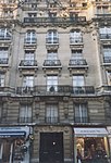
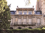
Rue de la Pompe
Rue de la Pompe is a street in Paris, France, which was named after the pump which served water to the castle of Muette. With a length of 1690 metres, Rue de la Pompe is one of the longest streets in the 16th arrondissement. It runs from Avenue Paul Doumer (in the district of Muette) to Avenue Foch (in the district of Porte Dauphine). Originally, it was a small way and first mentioned in 1730. For a long time, Rue de la Pompe, which runs from South to North, was together with Rue de Longchamp (which runs from East to West) the main axis of Passy whose terrain was mainly used for agricultural reasons until it became a part of Paris on 1 January 1860.
Excerpt from the Wikipedia article Rue de la Pompe (License: CC BY-SA 3.0, Authors).Rue de la Pompe
Rue de la Pompe, Paris 16th Arrondissement (Paris)
Geographical coordinates (GPS) Address Nearby Places Show on map
Geographical coordinates (GPS)
| Latitude | Longitude |
|---|---|
| N 48.868333333333 ° | E 2.2813888888889 ° |
Address
Bechu
Rue de la Pompe
75116 Paris, 16th Arrondissement (Paris)
Ile-de-France, France
Open on Google Maps


