place

St Mary Aldermary

17th-century Church of England church buildingsChristopher Wren church buildings in LondonChurch of England church buildings in the City of LondonChurches bombed by the Luftwaffe in LondonChurches in the City of London
Diocese of LondonGrade I listed churches in the City of LondonRebuilt churches in the United Kingdom
St Mary Aldermary Church

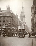
The Guild Church of St Mary Aldermary (or St Mary Elder Mary) is an Anglican church located in Watling Street at the junction with Bow Lane, in the City of London. Of medieval origin, it was rebuilt from 1510. Badly damaged in the Great Fire of London in 1666, it was rebuilt once more, this time by Sir Christopher Wren; unlike the vast majority of Wren's City churches, St Mary Aldermary is in the Gothic style.

Excerpt from the Wikipedia article St Mary Aldermary (License: CC BY-SA 3.0, Authors, Images).

St Mary Aldermary
Watling Street, City of London

Geographical coordinates (GPS) Address External links Nearby Places
placeShow on map

Wikipedia: St Mary AldermaryContinue reading on Wikipedia

Geographical coordinates (GPS)

Latitude Longitude
N 51.512777777778 ° E -0.093333333333333 °
placeShow on map

Address

St Mary Aldermary

Watling Street
EC4M 9BW City of London
England, United Kingdom
mapOpen on Google Maps

linkWikiData (Q916327)
linkOpenStreetMap (155419713)

St Mary Aldermary Church
Share experience

Nearby Places

Queen Street, London

Queen Street is a street in the City of London which runs between Upper Thames Street at its southern end to Cheapside in the north. The thoroughfares of Queen Street and King Street (a northward continuation of Queen Street beyond Cheapside) were newly laid out, cutting across more ancient routes in the City, following the Great Fire of London in 1666; they were the only notable new streets following the fire's destruction of much of the City.At the lower (southern) end of Queen Street is Southwark Bridge. The London Chamber of Commerce & Industry is located at No. 33. At the upper (northern) end the street crosses Cheapside and becomes King Street, which leads to Gresham Street and the Guildhall. This creates a direct route from the River Thames at Southwark Bridge up to the Guildhall. Queen Street meets the newer Queen Victoria Street as well as Cannon Street. Minor roads off the street include Skinners Lane (the home of the Worshipful Company of Skinners) and Cloak Lane. Two short sections of the street are pedestrianised, which together with a pedestrian-priority crossing of Cannon Street, forms a "Central Plaza" area. This was part of an award-winning public realm improvement scheme undertaken in 2006. This pedestrianised part of Queen Street has been used as a location for a number of art events organised by the City of London Festival and the London Architectural Biennale. Queen Street and King Street form part of an important route on the London Cycle Network which continues south over Southwark Bridge and north towards Moorgate. Queen Street runs through the wards of Vintry and Cordwainer, and is in the postal code area EC4. King Street is in the ward of Cheap and in postcode area EC2. King Street formed part of the marathon course of the 2012 Olympic and Paralympic Games. The women's Olympic marathon took place on 5 August and the men's on 12 August. The four Paralympic marathons were held on 9 September.

30 Cannon Street
30 Cannon Street

30 Cannon Street is a modern office building on Cannon Street in the City of London, close to Mansion House underground station. It was designed by Whinney, Son & Austen Hall as an office building for Crédit Lyonnais and built between 1974 and 1977. It became a Grade II listed building in 2015. The location was formerly the site of the city church of St Mildred, Bread Street, designed by Christopher Wren after the medieval church was destroyed in the Great Fire of London; the Wren church was bombed and destroyed in the Second World War. The site was one of the last bomb sites in London to be redeveloped. The building has six storeys with a raised basement. Its height was limited due to its proximity to St Paul's Cathedral to the north-west, and the high water table prevented a sub-basement. Its shape was constrained by its triangular island site, east of Bread Street, west of the junction where Cannon Street crosses Queen Victoria Street. It originally had an entrance on each façade (the western one on Bread Street has been removed) and a large central circular banking hall (also now removed). Although built for Crédit Lyonnais, it was designed so it could occupied by three separate banks, one in each corner of the building, but the interior has been significantly altered. The façades are characterised by tiers of repeating arched white frames around recessed windows of bronze-tinted glass, with each tier separated by a black granite string course which incorporates hidden drainage. The cladding units are pre-cast double-skinned 1.5 metres (4 ft 11 in) wide modules of glass fibre reinforced cement (GRC), using a mixture of Portland cement with 5% alkali-resistant glass fibre as reinforcement. It was the first building in the world to be entirely clad with GRC panels. Triple-width modules on the ground floor 4.5 metres (15 ft) wide have two canted windowpanes meeting at an angle, with similar modules repeated on upper floors to either side of the entrances. The slim profile and light weight of the GRC panels allowed the architect to slope the walls outward at an angle of five degrees, with each floor slightly larger than the one below, creating extra office space. The units of the partial upper floor are inverted, creating a roof line that resembles a crown to the north side and at the eastern end; a roof deck occupies at the south-western corner. Railings on the street have shapes similar to the cladding panels.