place

Montgomery County Police Department

1922 establishments in MarylandCounty police departments of MarylandGovernment agencies established in 1922Montgomery County, MarylandUse American English from February 2014
Use mdy dates from February 2014
Patch of the Montgomery County Police Department

The Montgomery County Police Department (MCPD), officially the Montgomery County Department of Police (MCP), is a nationally accredited agency and the primary law enforcement agency of Montgomery County, Maryland, providing the full spectrum of policing services to the entire county, including the Potomac River.Established in July 1922, the MCPD is headquartered in Gaithersburg, Maryland, and in addition to its primary duties, it also provides aid and assistance to other police departments including the Metropolitan Police Department of the District of Columbia, and in neighboring jurisdictions such as the District of Columbia, Howard County, Baltimore City, and Prince George's County as requested by authority.

Excerpt from the Wikipedia article Montgomery County Police Department (License: CC BY-SA 3.0, Authors, Images).

Montgomery County Police Department
Main Street Shared Use Path, Gaithersburg Kentlands

Geographical coordinates (GPS) Address Nearby Places
placeShow on map

Wikipedia: Montgomery County Police DepartmentContinue reading on Wikipedia

Geographical coordinates (GPS)

Latitude Longitude
N 39.11303 ° E -77.236462 °
placeShow on map

Address

MCFRS Headquarters

Main Street Shared Use Path
20878 Gaithersburg, Kentlands
Maryland, United States
mapOpen on Google Maps

Patch of the Montgomery County Police Department
Share experience

Nearby Places

North Potomac, Maryland

North Potomac is a census-designated place and unincorporated area in Montgomery County, Maryland, United States. It is located less than 5 miles (8.0 km) north of the Potomac River, and is about 20 miles (32 km) from Washington, D.C. It has a population of 23,790 as of 2020.The region's land was originally used for growing tobacco, which was replaced by wheat and dairy farming after the soil became depleted. The Chesapeake and Ohio Canal was used by local farmers to ship their grain (or flour made from the grain at the local mills), and two former canal locks are located less than 5 miles (8.0 km) away in the Chesapeake and Ohio Canal National Historical Park. In addition, infrastructure remains for what was one of the state's leading dairy farms during the first half of the 20th century. North Potomac did not get an identity of its own until 1989, when the United States Post Office allowed the use of the North Potomac name for what is mostly a collection of housing sub-divisions, farms, and wooded parks. The United States Census Bureau listed a North Potomac in 1970 but not 1980. In 2000, it began recognizing North Potomac as a census designated place. Today, the community benefits from its proximity to workplaces such as the Shady Grove Hospital area and the I-270 Technology Corridor. Washington, D.C. is accessible by automobile or public transportation. The median household income is nearly $160,000, and nearly half of the eligible residents have a graduate or professional degree.

Gaithersburg, Maryland

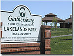
Gaithersburg ( GAY-thərz-burg), officially the City of Gaithersburg, is a city in Montgomery County, Maryland, United States. At the time of the 2020 U.S. Census, Gaithersburg had a population of 69,657, making it the ninth-largest community in the state. Gaithersburg is located to the northwest of Washington, and is considered a suburb and a primary city within the Washington–Arlington–Alexandria, DC–VA–MD–WV Metropolitan Statistical Area. Gaithersburg was incorporated as a town in 1878 and as a city in 1968. Gaithersburg is located east and west of Interstate 270. The eastern section includes the historic area of the town. Landmarks and buildings from that time can still be seen in many places but especially in the historic central business district of Gaithersburg called "Olde Towne". The east side also includes City Hall, and the Montgomery County Fair grounds, and Bohrer Park (a well-known joint community recreation center and outdoor water park for kids and families). The west side of the city has many wealthier neighborhoods that were designed with smart growth techniques and embrace New Urbanism. These include the Kentlands community, the Lakelands community, and the Washingtonian Center (better known as Rio), a shopping/business district. Two New Urbanism communities are under construction, including Watkins Mill Town Center (Casey East and West), and the massive "Science City". The state has a bus rapid transit line, Corridor Cities Transitway or "CCT", planned for the western portion of the city starting at Shady Grove Metro Station and connecting all the high density western Gaithersburg neighborhoods with a total of eight stops planned in the city. The National Institute of Standards and Technology (NIST) is headquartered in Gaithersburg directly west of I-270. Other major employers in the city include IBM, Lockheed Martin Information Systems and Global Services business area headquarters, AstraZeneca, and the French multinational corporation, Sodexo. Gaithersburg is also the location of the garrison of the United States Army Reserve Legal Command. Gaithersburg is noted for its ethnic and economic diversity; it was ranked second for ethnic diversity among the 501 largest U.S. cities, and first among smaller U.S. cities, by WalletHub in 2021.