Duchy of Jülich

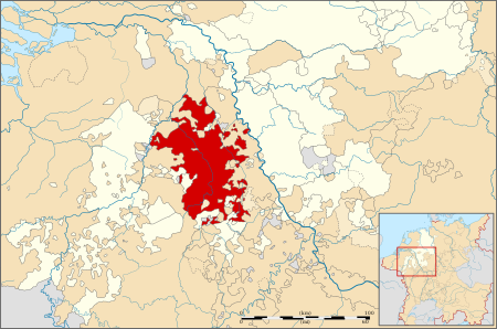
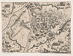
The Duchy of Jülich (German: Herzogtum Jülich; Dutch: Hertogdom Gulik; French: Duché de Juliers) comprised a state within the Holy Roman Empire from the 11th to the 18th centuries. The duchy lay west of the Rhine river and was bordered by the Electorate of Cologne to the east and the Duchy of Limburg to the west. It had territories on both sides of the river Rur, around its capital Jülich – the former Roman Iuliacum – in the lower Rhineland. The duchy amalgamated with the County of Berg beyond the Rhine in 1423, and from then on also became known as Jülich-Berg. Later it became part of the United Duchies of Jülich-Cleves-Berg. Its territory lies in present-day Germany (part of North Rhine-Westphalia) and in the present-day Netherlands (part of the Limburg province), its population sharing the same Limburgish dialect.
Excerpt from the Wikipedia article Duchy of Jülich (License: CC BY-SA 3.0, Authors, Images).Duchy of Jülich
Linzenicher Straße,
Geographical coordinates (GPS) Address Nearby Places Show on map
Geographical coordinates (GPS)
| Latitude | Longitude |
|---|---|
| N 50.916666666667 ° | E 6.35 ° |
Address
Linzenicher Straße 22
52428
North Rhine-Westphalia, Germany
Open on Google Maps


