place

Burkeville Covered Bridge

1870 establishments in MassachusettsBridges in Franklin County, MassachusettsConway, MassachusettsCovered bridges on the National Register of Historic Places in MassachusettsNational Register of Historic Places in Franklin County, Massachusetts
Road bridges on the National Register of Historic Places in MassachusettsTourist attractions in Franklin County, MassachusettsWooden bridges in Massachusetts
Burkeville Covered Bridge, Conway MA

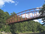
The Burkeville Covered Bridge is a historic covered bridge, carrying Main Poland Road over the South River in Conway, Massachusetts. Probably built in 1870, it is a regionally rare example of a multiple kingrod bridge with iron tensioning verticals (a modified Howe truss system), and one of a few 19th century covered bridges to survive in Massachusetts. It was listed on the National Register of Historic Places in 1988.

Excerpt from the Wikipedia article Burkeville Covered Bridge (License: CC BY-SA 3.0, Authors, Images).

Burkeville Covered Bridge
Main Poland Road,

Geographical coordinates (GPS) Address External links Nearby Places
placeShow on map

Wikipedia: Burkeville Covered BridgeContinue reading on Wikipedia

Geographical coordinates (GPS)

Latitude Longitude
N 42.507777777778 ° E -72.711111111111 °
placeShow on map

Address

Burkeville Covered Bridge

Main Poland Road
01341
Massachusetts, United States
mapOpen on Google Maps

linkWikiData (Q4998985)
linkOpenStreetMap (212592031)

Burkeville Covered Bridge, Conway MA
Share experience

Nearby Places

Conway School of Landscape Design

The Conway School (Conway) is a graduate program for sustainable landscape design and planning. It was founded in 1972 in a rural 24.5-acre (99,000 m2) campus in Conway, Massachusetts, and in 2015 opened a new campus in a renovated mill in Easthampton, Massachusetts. In 2018, the school moved to a renovated historic Coach House building in the Village Hill neighborhood of Northampton, Massachusetts. The graduate school offers a unique Master of Science degree in Ecological Design. The school accepts about twenty students each year into its 10-month program. The mission of the Conway School is to explore, develop, practice, and teach design that is ecologically and socially sustainable. The program puts particular emphasis on communication skills and community building. Students work on real projects with real clients at varying scales, from residential landscaping to urban planning and management of entire watersheds and food system. The curriculum and projects are designed to provide graduates with the basic knowledge and skills necessary to practice the planning, design, and management of the land that respects nature as well as humanity; develop ecological awareness, understanding, respect, and accommodation in the school's students and project clients; and produce projects that fit human use to natural conditions. Conway's founder, landscape architect and planner Walter Cudnohofsky, served as director from 1972 to 1992. Donald Walker, alum of the class of 1978, was the director from 1992 to 2005. Landscape architect Paul Cawood Hellmund served as director from 2006 to 2015. In 2016, the school adopted a shared leadership model. Currently, alum and former board member Bruce Stedman '78 is executive director, Ken Byrne is academic director and alum Priscilla Novitt is administrative director.

West Whately Historic District

The West Whately Historic District is a historic district encompassing over 700 acres (280 ha) of western Whately, Massachusetts. The area, located in the foothills of The Berkshires above the Connecticut River, has a long agricultural history, but also experienced a surge of industrial activity in the 19th century, of which only fragments remain. The district, listed on the National Register of Historic Places in 2003, is focused on the areas surrounding West Brook and the areas where there was once industrial activity. From the late 18th century into the early 20th, there were some 16 mill complexes in the area, of which only one still has a surviving structure. The principal elements that survive of this industrial past are foundations and evidence of water works such as dams and millraces. There are only two institutional buildings in the district: the West Whately Chapel, built in the Queen Anne style in 1896, and a schoolhouse that has since been converted to a residence.The oldest documented mill privilege on West Brook was granted about 1765 to Edward Brown, who operated a sawmill with his sons. This mill site was active into the 1920s, and was probably one of the longest-lived industrial sites. Privileges granted in the 1780s include one that was initially used for an oil mill, and another that included both grist and saw mills. At the mid-19th century, the area was that of the largest non-agricultural employment in the town, and also had several shops. The water-powered industries suffered due to reduced waterflows after the Northampton Reservoir was built in 1901, and most of the buildings were gone by the 1920s.