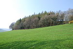
Chilmark, Wiltshire
Civil parishes in WiltshireEngvarB from July 2016Villages in Wiltshire

Chilmark is a Wiltshire village and civil parish of some 150 houses straddling the B3089 road, 11 miles (18 km) west of Salisbury, England. The parish includes the hamlets of Mooray and Portash, both close to the south of Chilmark village; and the dispersed hamlet of Ridge, to the southwest. The stream through the village, often dry in summer, flows some two miles (3 km) south to join the River Nadder. The Fonthill estate extends into the west of the parish as far as Ridge.
Excerpt from the Wikipedia article Chilmark, Wiltshire (License: CC BY-SA 3.0, Authors, Images).Chilmark, Wiltshire
Barberry,
Geographical coordinates (GPS) Address Nearby Places Show on map
Geographical coordinates (GPS)
| Latitude | Longitude |
|---|---|
| N 51.094 ° | E -2.045 ° |
Address
St Margaret of Antioch
Barberry
SP3 5AS , Chilmark
England, United Kingdom
Open on Google Maps


