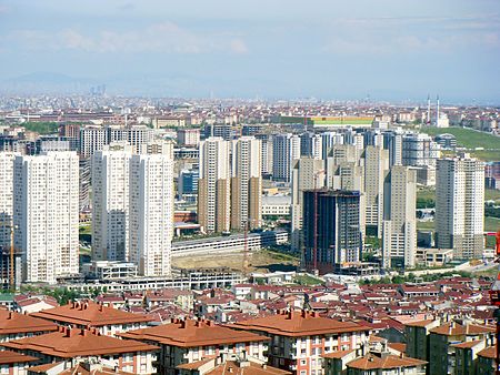
Esenyurt

Esenyurt (Turkish: [e's̪æn̪juɾt]) is a district of the Istanbul Province and is a part of the metropolitan municipality of Istanbul. Located in the European side of Istanbul, Esenyurt borders with Avcılar and Lake Küçükçekmece on the east, Büyükçekmece on the west, Başakşehir, Arnavutköy and TEM road on the north and Beylikdüzü and E-5 motorway on the south. The district covers an area of 2.770 hectares and has its own municipality since 1989. With the construction boom of large residential complexes in the area in the past few years, Esenyurt benefited from a major development. It now has four cultural centres, which are Esenyurt Cultural Centre, Saadetdere Cultural Centre, Yenikent Cultural Centre and Yunus Balta Cultural Centre. Four parks built in Esenyurt (Recep Tayyip Erdoğan Park, Şehitler Park, Gaziler Park and Kadir Topbaş Park) are also situated among the complexes.
Excerpt from the Wikipedia article Esenyurt (License: CC BY-SA 3.0, Authors, Images).Esenyurt
Esenyurt Meydanı,
Geographical coordinates (GPS) Address Nearby Places Show on map
Geographical coordinates (GPS)
| Latitude | Longitude |
|---|---|
| N 41.034280555556 ° | E 28.680119444444 ° |
Address
Cumhuriyet meydanı
Esenyurt Meydanı
34517
Turkey
Open on Google Maps


