place

Belchalwell

Former civil parishes in DorsetVillages in Dorset
Belchalwell CH
Belchalwell CH

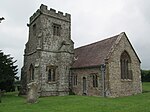
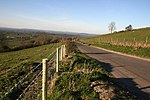
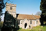
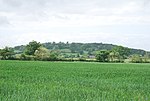
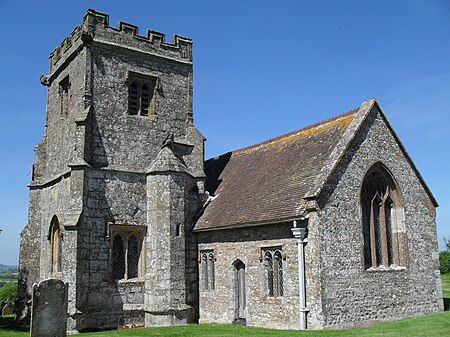
Belchalwell is a small village and former civil parish, now in the parish of Okeford Fitzpaine in the Blackmore Vale, in the Dorset district, in the ceremonial county of Dorset, England. It lies 2+1⁄2 miles (4 kilometres) south of Sturminster Newton and 6 miles (10 kilometres) northwest of Blandford Forum. Belchalwell Street is sited on Upper Greensand, with Lower Belchalwell on the boundary of Gault and Kimmeridge Clay, both beneath the north slopes of Bell Hill, part of the Dorset Downs. In 1881 the parish had a population of 169. On 25 March 1885 the parish was abolished and merged with Okeford Fitzpaine and Fifehead Neville.Belchalwell is Saxon in origin, with a medieval church, St Aldhelm's Church, much renovated. The name of the village describes a cold well on a hillside. The village has approximately 30 properties with fewer than a hundred residents, and is much reduced in size from former times, largely due to reductions in agricultural employment, which has always been the primary industry. One former resident was the TV personality Jack Hargreaves.

Excerpt from the Wikipedia article Belchalwell (License: CC BY-SA 3.0, Authors, Images).

Belchalwell
Garlands Lane,

Geographical coordinates (GPS) Address Nearby Places
placeShow on map

Wikipedia: BelchalwellContinue reading on Wikipedia

Geographical coordinates (GPS)

Latitude Longitude
N 50.8866 ° E -2.2985 °
placeShow on map

Address

Garlands Lane

Garlands Lane
DT11 0EQ , Okeford Fitzpaine
England, United Kingdom
mapOpen on Google Maps

Belchalwell CH
Belchalwell CH
Share experience

Nearby Places

Piddles Wood
Piddles Wood

Piddles Wood is a small area of woodland south of the River Stour, Dorset, and a Site of Special Scientific Interest (SSSI). The site was notified as an SSSI in 1985. The nearest settlement is the town of Sturminster Newton. The local planning authority is North Dorset District Council and Dorset County Council, but part of the site is managed by the Dorset Naturalists' Trust.Piddles Wood was first documented in the 13th century as Puttekwurth and Putteleswurthe. A "wurth" is an enclosure, and "Pyttel" was an Old English surname, so the name could mean "Pyttel's enclosure". However, another etymology is possible as "puttoc" is an Old English word for a kite, with "pyttel" or "piddle" also being used. It is also known as "Hanging Ground".The area of the site is 62.2 hectares (154 acres). Woodlands in North Dorset are scarce, and Piddles Wood is one of only a handful of such sites. Due to the heavy neutral and lighter acid soil types—caused by the underlying Kimmeridge Clay and Plateau Gravels—the site has a varying woodland flora, containing broadleaved, mixed and yew lowland. However, it is dominated by oak and coppiced hazel—for which reason the site was listed as an SSSI—and its flora and fauna is typical of oak woodland in Dorset. Piddles Wood has an abundance of ground flora, including woodruff (Galium odoratum), sanicle (Sanicula europaea), early purple orchid (Orchis mascula), wood spurge (Euphorbia amygdaloides) and orpine (Sedum telephium). The site is also very rich for insect fauna, and among the butterflies found on the site are the white admiral (Limenitis camilla), wood white (Leptidea sinapis) and silver-washed fritillary (Argynnis paphia); it was previously home to the pearl-bordered fritillary (Boloria euphrosyne), although this is now believed to be extinct in Dorset. Adjacent to the edge of the site is an extensive poultry farm, containing approximately 100,000 birds.