place

Okeford Fitzpaine

EngvarB from June 2016Villages in Dorset
050623 056 uk dor of

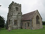
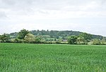
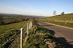
Okeford Fitzpaine is a village and civil parish in the English county of Dorset, situated in the Blackmore Vale three miles (five kilometres) south of the town of Sturminster Newton. It is sited on a thin strip of greensand under the scarp face of the Dorset Downs. In the 2011 census the civil parish—which includes the village of Belchalwell to the west and most of the hamlet of Fiddleford to the north—had 404 dwellings, 380 households and a population of 913.

Excerpt from the Wikipedia article Okeford Fitzpaine (License: CC BY-SA 3.0, Authors, Images).

Okeford Fitzpaine
The Cross,

Geographical coordinates (GPS) Address Nearby Places
placeShow on map

Wikipedia: Okeford FitzpaineContinue reading on Wikipedia

Geographical coordinates (GPS)

Latitude Longitude
N 50.8981 ° E -2.2768 °
placeShow on map

Address

The Cross

The Cross
DT11 0RN , Okeford Fitzpaine
England, United Kingdom
mapOpen on Google Maps

050623 056 uk dor of
Share experience

Nearby Places

Piddles Wood
Piddles Wood

Piddles Wood is a small area of woodland south of the River Stour, Dorset, and a Site of Special Scientific Interest (SSSI). The site was notified as an SSSI in 1985. The nearest settlement is the town of Sturminster Newton. The local planning authority is North Dorset District Council and Dorset County Council, but part of the site is managed by the Dorset Naturalists' Trust.Piddles Wood was first documented in the 13th century as Puttekwurth and Putteleswurthe. A "wurth" is an enclosure, and "Pyttel" was an Old English surname, so the name could mean "Pyttel's enclosure". However, another etymology is possible as "puttoc" is an Old English word for a kite, with "pyttel" or "piddle" also being used. It is also known as "Hanging Ground".The area of the site is 62.2 hectares (154 acres). Woodlands in North Dorset are scarce, and Piddles Wood is one of only a handful of such sites. Due to the heavy neutral and lighter acid soil types—caused by the underlying Kimmeridge Clay and Plateau Gravels—the site has a varying woodland flora, containing broadleaved, mixed and yew lowland. However, it is dominated by oak and coppiced hazel—for which reason the site was listed as an SSSI—and its flora and fauna is typical of oak woodland in Dorset. Piddles Wood has an abundance of ground flora, including woodruff (Galium odoratum), sanicle (Sanicula europaea), early purple orchid (Orchis mascula), wood spurge (Euphorbia amygdaloides) and orpine (Sedum telephium). The site is also very rich for insect fauna, and among the butterflies found on the site are the white admiral (Limenitis camilla), wood white (Leptidea sinapis) and silver-washed fritillary (Argynnis paphia); it was previously home to the pearl-bordered fritillary (Boloria euphrosyne), although this is now believed to be extinct in Dorset. Adjacent to the edge of the site is an extensive poultry farm, containing approximately 100,000 birds.

Fiddleford Manor
Fiddleford Manor

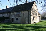
Fiddleford Manor (also known as Fiddleford Mill) is a medieval manor house located near Sturminster Newton, Dorset. It is thought to have been originally built around 1370 for William Latimer, the sheriff of Somerset and Dorset, after the manor passed to him in 1355. The house is now owned by English Heritage and open for the public to visit throughout the year; however, there is an adjoining building to the north that continues to serve as a private residence and is not open to the public.The present day site—set in a T-shape—comprises a two-storey solar and half of the hall to the east of that, both with open timber roofs; the foundations of the west range and an extension of the hall are now visible only as earthworks. The house is unusual among its class of building in retaining many of its original features; this despite having undergone many alterations during its 600-year history. It has been described as having "perhaps the most spectacular manor house interior in Dorset." In the sixteenth century the solar wing was extended to the north and the hall remodeled by architect Thomas White and his wife Anne; the house remained in the White family until at least the time of Charles I. After the Restoration, it was bought by Sir Thomas Freke and retained by his descendants, the Pitt-Rivers family; they reduced the length of the hall by 2 metres (6.6 ft), it having previously extended almost to the River Stour, and added a new fireplace and ceiling. By 1956, however, the 18th-century building had been demolished and the original, 14th-century part was derelict; by 1962, only the northern wing remained habitable, and the original section passed into state ownership. The house underwent restoration during the 1970s by the Department for the Environment—now the Department for Environment, Food and Rural Affairs (DEFRA).