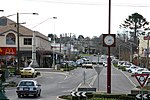
Drouin, Victoria
Shire of Baw BawTowns in Victoria (Australia)Towns in West GippslandUse Australian English from August 2019

Drouin is a town in the West Gippsland region, 90 kilometres (56 mi) east of Melbourne, in the Australian state of Victoria. Its local government area is the Shire of Baw Baw, and is home to the council headquarters despite being the second-largest town in the shire, behind neighbouring Warragul. The town is supposedly named after a Frenchman who invented a chlorination process for the extraction of ore, or an Aboriginal word meaning "north wind". New housing developments have accelerated the town's residential growth in recent years. As at the 2016 census, Drouin had a population of 11,887 people.
Excerpt from the Wikipedia article Drouin, Victoria (License: CC BY-SA 3.0, Authors, Images).Drouin, Victoria
Church Street, Shire of Baw Baw
Geographical coordinates (GPS) Address Nearby Places Show on map
Geographical coordinates (GPS)
| Latitude | Longitude |
|---|---|
| N -38.133333333333 ° | E 145.85 ° |
Address
Church Street
Church Street
3818 Shire of Baw Baw
Victoria, Australia
Open on Google Maps


