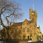
Shawfield

Shawfield is an industrial/commercial area of the Royal Burgh of Rutherglen in South Lanarkshire, Scotland, located to the north of the town centre. It is bordered to the east by the River Clyde, to the north by the Glasgow neighbourhood of Oatlands and the adjacent Richmond Park, to the south-west by Glasgow's Polmadie and Toryglen districts, and to the south-east by Rutherglen's historic Main Street and its Burnhill neighbourhood, although it is separated from these southerly areas by the West Coast Main Line railway tracks and the M74 motorway. A road bridge connects Shawfield to the Dalmarnock, Bridgeton and Glasgow Green areas. Shawfield is a familiar name to many Scottish sports fans, as the stadium of that name is the national venue for greyhound racing and the former home of Clyde F.C.
Excerpt from the Wikipedia article Shawfield (License: CC BY-SA 3.0, Authors, Images).Shawfield
Glasgow Road,
Geographical coordinates (GPS) Address Nearby Places Show on map
Geographical coordinates (GPS)
| Latitude | Longitude |
|---|---|
| N 55.833 ° | E -4.223 ° |
Address
Glasgow Road
Glasgow Road
G73 1TN , Shawfield
Scotland, United Kingdom
Open on Google Maps


