place

Bassetts Pole

Border tripointsVillages in WarwickshireWarwickshire geography stubs
Bassett's Pole Public House and signpost geograph.org.uk 369725

Bassetts Pole is an area at the Staffordshire–West Midlands–Warwickshire tripoint. Population details can be found under Middleton, Warwickshire. It is sited on the A446 London Road at its junction with the A38.

Excerpt from the Wikipedia article Bassetts Pole (License: CC BY-SA 3.0, Authors, Images).

Bassetts Pole
Withy Hill Road, North Warwickshire

Geographical coordinates (GPS) Address Nearby Places
placeShow on map

Wikipedia: Bassetts PoleContinue reading on Wikipedia

Geographical coordinates (GPS)

Latitude Longitude
N 52.578709 ° E -1.774807 °
placeShow on map

Address

Withy Hill Road

Withy Hill Road
B75 6JZ North Warwickshire
England, United Kingdom
mapOpen on Google Maps

Bassett's Pole Public House and signpost geograph.org.uk 369725
Share experience

Nearby Places

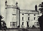
Langley Hall, West Midlands

Langley Hall was a manor house just off Fox Hollies Road, one mile from the centre of Walmley in Sutton Coldfield in the historic county of Warwickshire. The date of construction is unknown; however, by the 13th century, it was the seat of de Beresfords of Wishaw. One member of the family was the Chief Justice of the Common Pleas in 1289, and another was a confidential retainer to the Black Prince. Langley Hall was a large house, with a moat surrounding it and a pond and fishery within its grounds. It was held by the Earl of Warwick. In 1327, Edmund de Beresford had licence to crenellate the house, making it into a fortified building. The hall passed into the ownership of the Hores before being owned by the Pudseys, strong supporters of the Parliamentarians during the English Civil War. In the reign of Henry VII, Edith Hore formed a relationship with Rowland Pudsey, and they soon married resulting in Rowland acquiring the hall and estate. One of his descendants, Henry Pudsey, died in 1677, leaving two daughters, Elizabeth and Anne, plus a widow, Jane Pudsey. She later married William Wilson who was a local architect, builder and sculptor. Her daughters disapproved of the marriage and Jane was forced to leave the house. Anne, the younger of the two daughters, inherited the hall following her father's death. Elizabeth Pudsey went on to marry William Jesson, who built Four Oaks Hall with the help of William Wilson. The history of the hall is unknown during the 18th century; however, it is known that it was rebuilt in brick. The hall was then sold by the grandson of Jenson to Andrew Hackett and in 1815, it was bequeathed to George Bowyer Adderley. In 1817, George Bowyer Adderley sold the hall to Robert Peel who immediately demolished the hall for no indicated reason. The moat remained; however, it did sustain some damage from the demolition of the hall. During the history of the hall, a farm served the owners. As part of this farm was a windmill, one of only two in the area, the other being located in Maney. A watermill was also operating in the estate for a short time. Both mills were used in the process of corn milling. The site, now in Birmingham in the West Midlands, is currently occupied by a private residence named Langley House. The moat remains, however, has been drained and is overgrown with plants. Nearby is Langley Hall Farm, which used to serve the hall. Built in the Queen Anne style, it was refurbished in the 1990s into private residences with a landscaped courtyard.

Falcon Lodge
Falcon Lodge

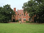
Falcon Lodge (SP 141 962) is the area of Sutton Coldfield, Birmingham, West Midlands, England, covered in predominantly council houses forming the Falcon Lodge Estate. It is located between Whitehouse Common and Reddicap Heath. To the west of the estate lies Rectory Park. It forms part of the edge of the Sutton Coldfield conurbation and the English countryside. The estate takes its name from the house built on newly enclosed common land in 1820. In 1852 the estate comprised some 54 acres (22 ha) of meadow, pasture and arable land. In 1937 the Sutton Coldfield Corporation acquired the house and land for £39,500 for the provision of local authority housing. The resultant Falcon Lodge estate was built between 1948-1956, with the original house still standing and occupied by a family of tenants, including Annie Smith, until 1954. There are two secondary schools opposite each other: John Willmott School and Fairfax Academy. The road (Fairfax Road) on which Fairfax School lies acts as the border of the estate. There is also a primary school called Newhall (formerly Springfield School) and Langley School on Lindridge Road (a special needs school). This was demolished in 2010. Woodington Infants School, just off Woodington Road was demolished in 2007/2008. The estate and surrounding area is served by several local Christian churches including St Chads (Anglican) on Hollyfield Road; Falcon Lodge Methodist Church on Newdigate Road; Falcon Lodge Chapel(Evangelical), Reddicap Heath Road; Holy Cross and St Francis (Catholic), Springfield Road. Sutton Christian Centre(Pentecostal) uses Falcon Lodge Community Centre for their main meetings and Falcon Lodge Chapel for their youth activities. Other denominations are represented with Jehovah's Witnesses Kingdom Hall in Springfield Road and the Seventh Day Adventist Church meet at Falcon Lodge Community Centre. Second Thoughts is a church-sponsored community shop and information centre operating from shop premises on Churchill Parade. The estate is split by a small stream, Churchill Brook, along which Churchill Road is situated. This road is the main route used by National Express West Midlands buses travelling through the estate. The stream flows into Langley Brook, a tributary of the River Tame, whose waters flow, via the River Trent and the Humber, into the North Sea. The Falcon Lodge area is served by the Sutton Trinity electoral ward which came into being in 2004. The area has a row of shops running along Churchill Road and a community centre, offering classes and activities for young and old. There is also an intergenerational community music programme, Live In The Lodge, which runs throughout the year for local residents and school children, featuring a community choir, weekly instrumental classes and workshops, and professional guest performances in the Community Centre.

Roughley
Roughley

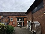
Roughley is an electoral ward within the Royal Town of Sutton Coldfield, and is the most northerly part of the administrative area covered by the Royal Sutton Coldfield Town Council and the City of Birmingham. Over half of Roughley Ward is attractive Green Belt countryside, including arable and dairy farms, historic field boundaries survive with mature hedgerows and woodlands. Several public footpaths provide access to the countryside and the one linking Hillwood Road and Dale Farm provides distant views of Lichfield Cathedral and on a clear day the Pennine Hills. Roughley was historically part of the county of Warwickshire and is now within the West Midlands. It includes parts of the old parishes of Hill and Canwell, and before May 2018 most of the area was within Four Oaks Ward. Local facilities within Roughley include the Mitchell Centre with independent shops, an art gallery, and bistro, all in premises converted from agricultural buildings, and nearby is the Chase Farm Shop with links to the farmer and butcher, Walter Smith. Roughley Ward includes the Moor Hall Estate, containing Moor Hall Farm House, (listed grade II*), dating from the late fourteenth century, which was the birthplace of John Vesey, Bishop of Exeter (born circa 1462), who became the great benefactor of Sutton Coldfield through his connections with King Henry VIII. The estate also includes Moor Hall Hotel upon the site of the former mansion built by John Vesey for his own occupation, and there is also a golf course and exclusive housing. John Vesey built 51 stone houses for the people of Sutton Coldfield in the sixteenth century and surviving houses within Roughley Ward include Vesey Grange (grade II* listed), on Weeford Road, and Vesey Cottage, (grade II* listed), upon the land of Wheatmoor Farm, accessed off Withyhill Road. Other notable buildings include Ashfurlong Hall, (grade II* listed), Tamworth Road, a manor house dating mainly from the late eighteenth century, but incorporating earlier sixteenth century buildings. Roughley Ward includes the Harvest Fields development, built by Barratt Homes and Crest Nicholson at the start of the twenty-first century, with several hundred homes arranged around a small park containing a community centre and nursery school, together with an access to Little Sutton Primary School.