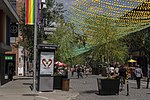
Papineau Avenue

Papineau Avenue (officially in French: avenue Papineau) is the longest north–south street in Montreal, Quebec, Canada. The part of the street between Henri Bourassa Boulevard and Quebec Autoroute 40 is the Montreal portion of Quebec Autoroute 19, commonly referred to as Autoroute Papineau. North of Henri Bourassa Boulevard, it becomes a true autoroute before crossing the Rivière des Prairies on the Papineau-Leblanc Bridge. In the south, the avenue ends at Notre-Dame Street.It traverses the boroughs of Ville-Marie, Le Plateau-Mont-Royal, Rosemont–La Petite-Patrie, Villeray-St-Michel-Parc-Extension and Ahuntsic-Cartierville. The street is named after Joseph Papineau, Lower Canadian politician and father of Louis-Joseph Papineau, the leader of the reformist Patriote movement and belligerent in the Lower Canada Rebellion of 1837.
Excerpt from the Wikipedia article Papineau Avenue (License: CC BY-SA 3.0, Authors, Images).Papineau Avenue
Avenue Papineau, Montreal Ville-Marie
Geographical coordinates (GPS) Address Nearby Places Show on map
Geographical coordinates (GPS)
| Latitude | Longitude |
|---|---|
| N 45.522922 ° | E -73.553074 ° |
Address
Avenue Papineau 1461
H2L 2J4 Montreal, Ville-Marie
Quebec, Canada
Open on Google Maps


