place

Holy Trinity Catholic Church (Honolulu)

Buildings and structures in HonoluluHawaii building and structure stubsHonolulu stubsRoman Catholic Diocese of HonoluluRoman Catholic churches in Hawaii
United States Roman Catholic church stubsWestern United States church stubs
Holy Trinity Church Kuliʻouʻou, Hawaii 01

Holy Trinity is a Roman Catholic church located in Honolulu, Hawaiʻi. Holy Trinity Church is located in the East Honolulu neighborhood of Kuliʻouʻou on the island of Oʻahu, at 5919 Kalanianaole Highway (Route 72), 21°16′59″N 157°43′45″W. The church serves the communities of Niu Valley, Kuliʻouʻou, and Hawaiʻi Kai. It falls under the jurisdiction of the Diocese of Honolulu and the bishop of Honolulu.

Excerpt from the Wikipedia article Holy Trinity Catholic Church (Honolulu) (License: CC BY-SA 3.0, Authors, Images).

Holy Trinity Catholic Church (Honolulu)
Kalaniana’ole Highway, East Honolulu Niu Valley

Geographical coordinates (GPS) Address Nearby Places
placeShow on map

Wikipedia: Holy Trinity Catholic Church (Honolulu)Continue reading on Wikipedia

Geographical coordinates (GPS)

Latitude Longitude
N 21.283055555556 ° E -157.72916666667 °
placeShow on map

Address

Kalaniana’ole Highway 5905
96821 East Honolulu, Niu Valley
Hawaii, United States
mapOpen on Google Maps

Holy Trinity Church Kuliʻouʻou, Hawaii 01
Share experience

Nearby Places

Maunalua Bay
Maunalua Bay

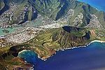
Maunalua Bay is a bay in the southeast of Honolulu, the capital of Hawaiʻi. The bay extends about 6.3 miles (10.1 kilometers) from the southern tip of Diamond Head, the Black Point, also called Kūpikipikiʻō , in the west to Portlock Point, also known as Kawaihoa Point, to the east. On the land side, just to the east of Diamond Head is the upmarket suburb of Kāhala. Following are several affluent hillside suburbs like Hawaii Loa Ridge, a gated community that occupies an entire slope. In the east is the suburb of Hawaii Kai, built by industrialist Henry J. Kaiser after World War II. Hawaii Kai has a marina, shopping centers, including a Costco, Walgreens, Longs, and Safeway, and numerous restaurants such as the well-known Roy's and Kona Brewing Co. pub. On the headland leading to Koko Head is the suburb of Portlock, which is a part of Hawaii Kai. The name Maunalua (from Mauna = mountain and [ʻe]lua = two, in the native Hawaiian language) refers to the designation of the area what is now referred to as "Hawaii Kai." The mountains, located inland from Portlock Point, are the 645 feet (197 meters) high Koko Head, and about 2.2 miles (3.5 kilometers) east thereof, close to Hanauma Bay the Koko Crater, the walls of which rise up to 1,207 feet (368 meters). According to one legend, Maunalua was one of the first settlements when settlers arrived in Hawaiʻi around the 12th century. Native Hawaiians originally lived there by fishing and cultivating sweet potatoes (ʻuala) along the coastal plains at a place called Ke-kula-O Kamauwai. Maunalua was formerly famous for having the largest Native Hawaiian fishpond (loko iʻa) on Oʻahu. The 523 acre fishpond known as Keahupua-O-Maunalua had a wall or kuapā which originally spanned from Kuliʻouʻou headland and to what is now Portlock. The pond was used primarily to raise mullet (ʻanae) and was also home to a multitude of endemic or indigenous waterbirds. The area continued to be important for fishing and agriculture until the 1950s when the fishpond was filled for housing development.

Koko Head
Koko Head

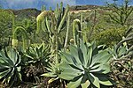
Koko Head is the headland that defines the eastern side of Maunalua Bay along the southeastern side of the Island of Oahu in Hawaii. On its western slope is the community of Portlock, a part of Hawaiʻi Kai. Koko Head (at 642 ft or 196 m) is an ancient tuff cone that is somewhat dwarfed by its neighboring tuff cone, Koko Crater, with its peak, Kohelepelepe (or Puʻu Mai), rising to 1208 ft or 368 m. Koko Head itself has three significant depressions or old vents, the largest of which forms the well-known Hanauma Bay. Koko Head's last eruption was 3,000-5,000 years ago and it is part of the Honolulu Volcanics.This eastern end of Oʻahu is quite scenic and most of the area is part of Koko Head Regional Park, administered by the City & County of Honolulu. The following features and natural areas are found between Koko Head and the eastern end of the island at Makapuʻu: Koko Crater is a large tuff cone that visually dominates the area. Within the crater are horse stables and the Koko Crater Botanical Garden specializing in cacti and succulents. Hanauma Bay is a tuff ring breached by the ocean. Lānaʻi Lookout is a scenic lookout that features a very distant view of the Island of Lānaʻi to the southeast of Oʻahu. Molokaʻi, directly across the Ka'iwi Channel, is closer and nearly always visible during the day; Lānaʻi is visible only under good atmospheric conditions, although if visible from anywhere on Oʻahu, it will be visible from this pull-out/parking area. The cremated ashes of Barack Obama's mother and maternal grandmother were scattered here in 1995 and 2008. Hālona Blowhole is a blowhole in the rocky shore. A large pull-out/parking area is present. The adjacent Hālona Cove is best known as the site of the love scene between Burt Lancaster and Deborah Kerr in the movie From Here to Eternity. Sandy Beach is a popular beach for surfing and a park popular for kite flying because trade winds (offshore here) are strong and steady most days. Sea conditions off the beach tend to be rough most of the time and the bottom drops away relatively quickly, so this is not a beach for relaxed swimming, but very popular for more extreme water sports and watchers.