Heald Green
Areas of StockportGreater Manchester geography stubs
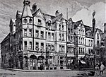
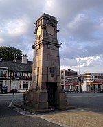
Heald Green is a suburb of Stockport, in Greater Manchester, England. It is located in the south-west of the Metropolitan Borough of Stockport, near to Manchester Airport and within the boundaries of the historic county of Cheshire. Heald Green is bordered by Gatley and Cheadle to the north, Cheadle Hulme to the east, Handforth and Styal to the south, and Moss Nook and Peel Hall to the west.
Excerpt from the Wikipedia article Heald Green (License: CC BY-SA 3.0, Authors).Heald Green
Grasmere Road,
Geographical coordinates (GPS) Address Nearby Places Show on map
Geographical coordinates (GPS)
| Latitude | Longitude |
|---|---|
| N 53.3804 ° | E -2.229 ° |
Address
Grasmere Road
Grasmere Road
SK8 4RG
England, United Kingdom
Open on Google Maps


