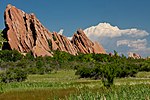
High Line Canal
Buildings and structures in Adams County, ColoradoCanals in ColoradoCanals opened in 1883Geography of Aurora, ColoradoGeography of Denver ... and 14 more
GreenwaysHistoric American Engineering Record in ColoradoIrrigation canalsIrrigation in the United StatesNational Recreation Trails in ColoradoParks in ColoradoProtected areas of Adams County, ColoradoProtected areas of Arapahoe County, ColoradoProtected areas of DenverProtected areas of Douglas County, ColoradoTransportation buildings and structures in Arapahoe County, ColoradoTransportation buildings and structures in DenverTransportation buildings and structures in Douglas County, ColoradoTransportation in Adams County, Colorado
The High Line Canal (HLC) is a man-made waterway, used for irrigation and recreation, that serves the Denver-Aurora metropolitan area. It begins at a diversion dam on the South Platte River, some 1.8 miles (2.9 km) above the mouth of Waterton Canyon. From its headgate, the HLC runs generally northeast for 66 miles (106 km) (historically 71 miles), passing through Douglas, Arapahoe, Denver, and Adams Counties.
Excerpt from the Wikipedia article High Line Canal (License: CC BY-SA 3.0, Authors).High Line Canal
South Platte Canyon Road,
Geographical coordinates (GPS) Address Nearby Places Show on map
Geographical coordinates (GPS)
| Latitude | Longitude |
|---|---|
| N 39.48294 ° | E -105.11558 ° |
Address
Black Bear Rest Area
South Platte Canyon Road
80127
Colorado, United States
Open on Google Maps


