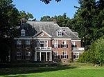
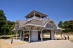
Huis ter Heide, Utrecht
Populated places in Utrecht (province)Utrecht (province) geography stubsZeist

Huis ter Heide is a village in the central Netherlands. It is located in the municipality of Zeist, Utrecht, about 2 km northeast of the centre of the town Zeist.
Excerpt from the Wikipedia article Huis ter Heide, Utrecht (License: CC BY-SA 3.0, Authors, Images).Huis ter Heide, Utrecht
Prins Alexanderweg,
Geographical coordinates (GPS) Address Nearby Places Show on map
Geographical coordinates (GPS)
| Latitude | Longitude |
|---|---|
| N 52.110833333333 ° | E 5.2563888888889 ° |
Address
Basisschool Oud Zandbergen
Prins Alexanderweg
3712 AD
Utrecht, Netherlands
Open on Google Maps


