place

Veterans of Foreign Wars Parkway

1931 establishments in MassachusettsBrookline, MassachusettsHistoric districts on the National Register of Historic Places in MassachusettsHistoric trails and roads in Dedham, MassachusettsJctint template hatnote tracking category
NRHP infobox with nocatNational Register of Historic Places in BostonNational Register of Historic Places in Brookline, MassachusettsParks on the National Register of Historic Places in MassachusettsParkways in MassachusettsRoads on the National Register of Historic Places in MassachusettsStreets in BostonTransportation in Norfolk County, MassachusettsU.S. Route 1Use mdy dates from April 2019Veterans of Foreign Wars
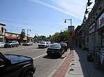
VFW Parkway near the Educational Complex, West Roxbury MA

The Veterans of Foreign Wars Parkway (referred to locally as the VFW Parkway) is a historic parkway in Boston, Massachusetts. The southern terminus of the parkway is at Washington Street at the Dedham-West Roxbury border, from where it travels north and then east, ending at a junction with Centre Street, near the Arnold Arboretum. The highway is almost entirely contained within the West Roxbury neighborhood, although it passes through part of the Chestnut Hill neighborhood near its junction with the West Roxbury Parkway. Most of its length, from Spring Street in West Roxbury to its eastern end, is administered by the Massachusetts Department of Conservation and Recreation (DCR), a successor to the Metropolitan District Commission (MDC) which oversaw the road's construction. The parkway was built in stages between 1930 and 1942, and was designed to provide a parkway connection from the Upper Charles River Reservation to other MDC parks via the West Roxbury Parkway. The DCR portion of the road was listed on the National Register of Historic Places in 2005. The road formerly carried the designation for U.S. Route 1.

Excerpt from the Wikipedia article Veterans of Foreign Wars Parkway (License: CC BY-SA 3.0, Authors, Images).

Veterans of Foreign Wars Parkway
Richwood Street, Boston West Roxbury

Geographical coordinates (GPS) Address Nearby Places
placeShow on map

Wikipedia: Veterans of Foreign Wars ParkwayContinue reading on Wikipedia

Geographical coordinates (GPS)

Latitude Longitude
N 42.286111111111 ° E -71.158611111111 °
placeShow on map

Address

Richwood Street 35
02132 Boston, West Roxbury
Massachusetts, United States
mapOpen on Google Maps

VFW Parkway near the Educational Complex, West Roxbury MA
Share experience

Nearby Places

West Roxbury
West Roxbury

West Roxbury is a neighborhood in Boston, Massachusetts bordered by Roslindale to the northeast, the village of Chestnut Hill and the town of Brookline to the north, the city of Newton to the northwest, the towns of Dedham and Needham to the southwest, and Hyde Park to the southeast. West Roxbury is often mistakenly confused with Roxbury, but the two are separated from each other by Roslindale and Jamaica Plain. Before 1630, the area was inhabited by the Wampanoag Indian Tribe. Founded in 1630 (contemporaneously with Boston), West Roxbury was originally part of the town of Roxbury and was mainly used as farmland. West Roxbury seceded from Roxbury in 1851, and was annexed by Boston in 1874. The town included the neighborhoods of Jamaica Plain and Roslindale. West Roxbury's main commercial thoroughfare is Centre Street. West Roxbury Main Streets is a local non-profit that works to enhance and promote the business district. The neighborhood has some two-family houses but mostly single family homes; many of Boston's civil servants live there. West Roxbury is home to District E-5 of the Boston Police Department, Boston Emergency Medical Services Ambulance 5 that posts at the intersection of West Roxbury Parkway at Centre St and Paramedic 5 stationed at the Faulkner Hospital provide EMS service, and there are two Boston fire stations, Ladder 25 & Engine 30 on Centre Street and Engine 55 on Washington Street. The Needham Branch of the MBTA Commuter Rail network has three stations in West Roxbury (Bellevue, Highland and West Roxbury). Several MBTA bus lines run through and/or terminate in West Roxbury. A large Veterans Affairs hospital is located opposite the Charles River on the VFW Parkway near the Dedham line. West Roxbury is home to several places of worship, including three Catholic parishes, churches of various Protestant denominations, and a Jewish synagogue. The neighborhood was home to an experimental transcendentalist Utopian community called Brook Farm, which attracted notable figures including Margaret Fuller and Nathaniel Hawthorne, whose 1852 novel The Blithedale Romance is based on his stay there.Like its neighboring communities, West Roxbury's residential development grew with the construction of the West Roxbury branch of the Boston and Providence Railroad; the area grew further with the development of electric streetcars.

Brook Farm
Brook Farm

Brook Farm, also called the Brook Farm Institute of Agriculture and Education or the Brook Farm Association for Industry and Education, was a utopian experiment in communal living in the United States in the 1840s. It was founded by former Unitarian minister George Ripley and his wife Sophia Ripley at the Ellis Farm in West Roxbury, Massachusetts (nine miles outside of downtown Boston), in 1841 and was inspired in part by the ideals of transcendentalism, a religious and cultural philosophy based in New England. Founded as a joint stock company, it promised its participants a portion of the farm's profits in exchange for an equal share of the work. Brook Farmers believed that by sharing the workload, they would have ample time for leisure and intellectual pursuits. Life on Brook Farm was based on balancing labor and leisure while working together for the greater community's benefit. Each member could choose whatever work they found most appealing and all were paid equally, including women. Revenue came from farming and from selling handmade products like clothing, as well as fees paid by the farm's many visitors. The main source of income was the school, which was overseen by Mrs. Ripley. A preschool, primary school, and a college preparatory school attracted children internationally and each child was charged for his or her education. Adult education was also offered. The community was never financially stable and had difficulty profiting from its agricultural pursuits. By 1844, the Brook Farmers adopted a societal model based on the socialist concepts of Charles Fourier and began publishing The Harbinger as an unofficial journal promoting Fourierism. Following his vision, the community began building an ambitious structure called the Phalanstery. When the uninsured building burned down, the community was financially devastated and never recovered. It was fully closed by 1847. Despite the commune's failure, many Brook Farmers looked back on their experience favorably. The commune's critics included Charles Lane, founder of another utopian community, Fruitlands. Nathaniel Hawthorne was a founding member of Brook Farm, though not a strong adherent of the community's ideals. He later fictionalized his experience in his novel The Blithedale Romance (1852). After Brook Farm closed, the property was operated for most of the next 130 years by a Lutheran organization, first as an orphanage, and then a treatment center and school. Fire destroyed the Transcendentalists' buildings over the years. In 1988, the State of Massachusetts acquired 148 acres (60 ha) of the farm, which is now operated by the Massachusetts Department of Conservation and Recreation as a historic site. Brook Farm was one of Massachusetts's first sites to be listed on the National Register of Historic Places and be designated a National Historic Landmark. In 1977, the Boston Landmarks Commission designated Brook Farm a Boston Landmark, the city's highest recognition for historic sites.