Bare, Morecambe
Geography of the City of LancasterLancashire geography stubsMorecambeMorecambe BayPopulated places in Lancashire ... and 2 more
Seaside resorts in LancashireUse British English from March 2015

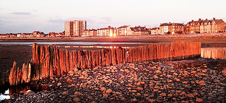
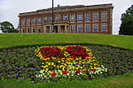
Bare is a suburb of and electoral ward in Morecambe, within the City of Lancaster district in Lancashire, England. The population of the ward as taken at the Census 2011 was 4,067. Bare has a high street (Princes Crescent), and a railway station connecting it to Morecambe and Lancaster. Its name comes from Anglo-Saxon bearu meaning "grove".Bare Hall is a Grade II listed building built around 1830 by the Lodge family
Excerpt from the Wikipedia article Bare, Morecambe (License: CC BY-SA 3.0, Authors, Images).Bare, Morecambe
Bare Lane, Lancaster Bare
Geographical coordinates (GPS) Address Nearby Places Show on map
Geographical coordinates (GPS)
| Latitude | Longitude |
|---|---|
| N 54.076 ° | E -2.837 ° |
Address
Bare Lane
Bare Lane
LA4 6RN Lancaster, Bare
England, United Kingdom
Open on Google Maps


