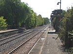
Colonel Light Gardens, South Australia

Colonel Light Gardens is a suburb located within the Australian City of Mitcham in the greater Adelaide region, approximately 7 km (4 mi) south of the Adelaide city centre. The area is 1.58 km2 (0.61 sq mi). Planned as a garden suburb, it is known for wide, tree-lined streets, presentable postwar bungalow homes, rounded street corners, and much manicured, well maintained open space. It contains Colonel Light Gardens Primary School, the Colonel Light Gardens RSL Sub-Branch, a number of sporting clubs using the name Reade Park, and a multitude of historical parks and gardens. It also contains many paved and unpaved laneways, alleyways and bike tracks. The suburb is of irregular shape and follows Goodwood Road. The major part of the suburb is east of Goodwood Road and is bounded by Grange Road (north), Goodwood Road (west), and Springbank Road (south), and the suburbs of Westbourne Park, Lower Mitcham, Clapham and Panorama. A smaller part of the suburb is west of Goodwood Road and divides the neighbouring Daw Park into two unjoined parts which are the northern and southern boundaries of this smaller part.
Excerpt from the Wikipedia article Colonel Light Gardens, South Australia (License: CC BY-SA 3.0, Authors, Images).Colonel Light Gardens, South Australia
Goodwood Road, Adelaide Daw Park
Geographical coordinates (GPS) Address Nearby Places Show on map
Geographical coordinates (GPS)
| Latitude | Longitude |
|---|---|
| N -34.982 ° | E 138.592 ° |
Address
Stop 15 Goodwood Road - West side
Goodwood Road
5041 Adelaide, Daw Park
South Australia, Australia
Open on Google Maps


