Mastin Moor
AC with 0 elementsChesterfield, DerbyshireDerbyshire geography stubsTowns and villages of the Peak DistrictVillages in Derbyshire
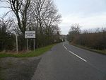
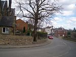
Mastin Moor is a village east of Staveley in Derbyshire, United Kingdom. The village sits almost entirely on the north side of the A619. As well as houses, the village consists of two local shops, a Chinese takeaway restaurant, and a Miners' Welfare Club. There were once two pubs in the village, but these were demolished in the mid-2000s, the land reclaimed for building houses and a hospital. The hospital soon closed due to funding issues.
Excerpt from the Wikipedia article Mastin Moor (License: CC BY-SA 3.0, Authors).Mastin Moor
Blunt Avenue,
Geographical coordinates (GPS) Address Nearby Places Show on map
Geographical coordinates (GPS)
| Latitude | Longitude |
|---|---|
| N 53.274 ° | E -1.324 ° |
Address
Blunt Avenue
Blunt Avenue
S43 3AP , Staveley CP
England, United Kingdom
Open on Google Maps


