place

River Doe Lea

AC with 0 elementsGeographic coordinate listsLists of coordinatesRivers of DerbyshireSites of Special Scientific Interest in Derbyshire
Doe Lea 627046 e34e4a22

The River Doe Lea is a river which flows near Glapwell and Doe Lea in Derbyshire, England. The river eventually joins the River Rother near Renishaw. The river contained 1,000 times the safe level of dioxins in 1991, according to a statement made by Dennis Skinner, (MP) in the House of Commons in 1992. The river flows through the site of the former Coalite plant near Bolsover, where coke, tar and industrial chemicals were manufactured until the plant closed in 2004. The stream section is designated an SSSI for its geological interest.

Excerpt from the Wikipedia article River Doe Lea (License: CC BY-SA 3.0, Authors, Images).

River Doe Lea
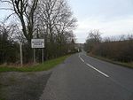
Hague Lane, North East Derbyshire

Geographical coordinates (GPS) Address Nearby Places
placeShow on map

Wikipedia: River Doe LeaContinue reading on Wikipedia

Geographical coordinates (GPS)

Latitude Longitude
N 53.2894 ° E -1.3373 °
placeShow on map

Address

Hague Lane

Hague Lane
S21 3WH North East Derbyshire
England, United Kingdom
mapOpen on Google Maps

Doe Lea 627046 e34e4a22
Share experience

Nearby Places

Renishaw, Derbyshire

Renishaw is a village in the district of North East Derbyshire in England. It is in the civil parish of Eckington.Renishaw lies on the A6135 road between the villages of Eckington and Barlborough. To the west is a section of the Trans Pennine Trail long distance footpath which runs along a former railway line. Adjacent to this is the route of the Chesterfield Canal which passes along the edge of the village. The canal is being restored in stages, with this section having some clearance work done in preparation for the section from Staveley to the south being reinstated. While Renishaw is the name for the village as a whole, in respect of the group of roads that lie south of the A6135, in the section of the highway that is locally named as Main Road (between Hague Lane (B6419) and Emmett Carr Lane), that part is named Emmett Carr.To the northwest of the village is Renishaw Hall, a country house belonging to the Sitwell family, who were owners of the local iron foundry before it was nationalised. The Sitwell estate is now occupied in part by Renishaw Park Golf course. Renishaw Ironworks, founded by the 17th-century ironmaster George Sitwell, was the main employer in the village for many years before its closure in the 1990s, when British Steel plc closed down non-core parts of its business. The site is now part business park and part housing estate. The other main employer in the area was the coalmining industry, as the area had several pits some of which originally supplied the iron works.The route of the Midland Railway from Chesterfield to Sheffield passed the village in the valley to the west, before the direct route through Dronfield and the Bradway Tunnel to the Sheffield was built. This route was the North Midland Railway from Derby to Leeds.