Diepenbeek
Belgian Limburg geography stubsMunicipalities of Limburg (Belgium)Pages including recorded pronunciationsPages with Dutch IPA

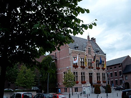
Diepenbeek (Dutch pronunciation: [ˈdipə(m)beːk] ; Limburgish: Diepenbik) is a municipality located in the Belgian province of Limburg near Hasselt. On January 1, 2012, Diepenbeek had a total population of 18,337. Its total area is 41.19 km² (15.9 sq mi) which gives a population density of 430 inhabitants per km² (1,203/sq mi). The municipality includes the communities and hamlets of Bijenberg, het Crijt, Dorpheide, Keizel, Lutselus, Pampert, Piannesberg, Reitje, Rooierheide, Rozendaal, and Zwartveld. It is home to Hasselt University, slowly expanding towards Hasselt itself. The Limburg Science Park is located on the university campus.
Excerpt from the Wikipedia article Diepenbeek (License: CC BY-SA 3.0, Authors, Images).Diepenbeek
Nanofstraat,
Geographical coordinates (GPS) Address Nearby Places Show on map
Geographical coordinates (GPS)
| Latitude | Longitude |
|---|---|
| N 50.9 ° | E 5.4 ° |
Address
Nanofstraat 131
3590
Limburg, Belgium
Open on Google Maps


