Watsonville Municipal Airport
Airports in Santa Cruz County, CaliforniaAirports in the San Francisco Bay AreaClosed installations of the United States NavyUse mdy dates from August 2022Watsonville, California

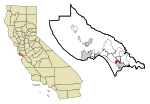
Watsonville Municipal Airport (IATA: WVI, ICAO: KWVI, FAA LID: WVI) is three miles (5 km) northwest of Watsonville, in Santa Cruz County, California, United States. The airport covers 330 acres (134 ha) and has two runways. The largest aircraft to ever land at Watsonville were 05-5141 and 05-5143, C-17 Globemaster IIIs from March ARB, California.
Excerpt from the Wikipedia article Watsonville Municipal Airport (License: CC BY-SA 3.0, Authors, Images).Watsonville Municipal Airport
Holly Drive,
Geographical coordinates (GPS) Address External links Nearby Places Show on map
Geographical coordinates (GPS)
| Latitude | Longitude |
|---|---|
| N 36.935833333333 ° | E -121.78972222222 ° |
Address
Watsonville Municipal Airport (Watsonville Municipal Airport)
Holly Drive
95019
California, United States
Open on Google Maps


