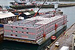
Phoenix breakwaters

The Phoenix breakwaters were a set of reinforced concrete caissons built as part of the artificial Mulberry harbours that were assembled as part of the preparations for the Normandy landings during World War II. They were constructed by civil engineering contractors around the coast of Britain. They were collected at Dungeness and Selsey, and then towed by tugboats across the English Channel and sunk to form the Mulberry harbour breakwaters replacing the initial "Gooseberry" block ships. Caissons were added in the autumn of 1944 to reinforce the existing structure to cope with the harbour continuing in use longer than planned. Several Phoenix breakwaters still exist in Britain: two are part of the harbour off Castletown at Portland Harbour in Dorset, and two can be dived in less than 10 metres of water off Pagham in West Sussex. There is also a smaller Phoenix Caisson (type C) in Langstone Harbour in Hampshire.A wrecked Phoenix breakwater is also to be seen, broken in two, in the Thames estuary off Shoeburyness in Essex. It broke while being towed from Harwich in June 1944. To avoid it causing a hazard to shipping in the Thames estuary, it was beached on the mud on the northern edge of the Thames dredged shipping channel. It is about a mile from the beach. It is not quite covered at high tide, but it is topped by a beacon to warn shipping of its presence. Several Phoenix breakwaters were used in the Netherlands to plug gaps in the dykes, four of them for a dyke at Ouwerkerk after the North Sea Flood of 1 February 1953. These four have now been converted into a museum for the floods called the Watersnoodmuseum. One can walk through the four caissons. Two of the Phoenix breakwaters were sold to Sweden in 1949, initially towed to Frihamnen port in Stockholm and moved on 20 September 1956 to the newly-built heat and power plant in Hässelby where they remain as of 2021.
Excerpt from the Wikipedia article Phoenix breakwaters (License: CC BY-SA 3.0, Authors, Images).Phoenix breakwaters
Castletown,
Geographical coordinates (GPS) Address Nearby Places Show on map
Geographical coordinates (GPS)
| Latitude | Longitude |
|---|---|
| N 50.571111111111 ° | E -2.4427777777778 ° |
Address
Castletown Pier
Castletown
DT5 1BD , Portland
England, United Kingdom
Open on Google Maps


