place

Honington Hall

1682 establishments in EnglandCountry houses in WarwickshireGrade I listed buildings in WarwickshireGrade I listed housesHouses completed in 1682
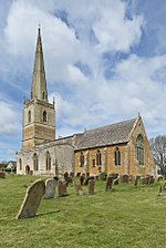
Honington Hall geograph.org.uk 1633764

Honington Hall is a privately owned 17th century country house at Honington, near Stratford on Avon, Warwickshire. It has Grade I listed building status. The Manor of Honington was in the ownership of the Priory of Coventry until the Dissolution of the Monasteries in the 16th century. In 1540 it was granted by the Crown to Robert Gibbes. The estate was sold by the Gibbes family in about 1670 to Henry Parker who in 1696 succeeded to the Parker Baronetcy and an estate at Melford Hall, Suffolk. The present house was built by Parker in 1682 but was sold by Parker's grandson in 1737 to Joseph Townsend who carried out considerable alterations and extensions in the mid 18th century. The Georgian style house has a number of fine features including round headed niches over the ground floor windows of the east front which contain busts of Roman Emperors. The Townsends held the estate until 1905 when it passed by marriage to Sir Grey Skipwith Bt ( see Skipwith baronets). Later the estate became the seat of the Wiggin family. The house is not generally open to the public but may be available for visitations by prior group arrangements.

Excerpt from the Wikipedia article Honington Hall (License: CC BY-SA 3.0, Authors, Images).

Honington Hall
Stratford Road, Stratford-on-Avon

Geographical coordinates (GPS) Address Nearby Places
placeShow on map

Wikipedia: Honington HallContinue reading on Wikipedia

Geographical coordinates (GPS)

Latitude Longitude
N 52.082 ° E -1.6206 °
placeShow on map

Address

Honington Hall

Stratford Road
CV36 4NH Stratford-on-Avon
England, United Kingdom
mapOpen on Google Maps

Honington Hall geograph.org.uk 1633764
Share experience

Nearby Places

Evolution of Worcestershire county boundaries since 1844

The administrative boundaries of Worcestershire, England have been fluid for over 150 years since the first major changes in 1844. There were many detached parts of Worcestershire in the surrounding counties, and conversely there were islands of other counties within Worcestershire. The 1844 Counties (Detached Parts) Act began the process of eliminating these, but the process was not completed until 1966, when Dudley was absorbed into Staffordshire. The expansion of Birmingham and the Black Country during and after the Industrial Revolution also altered the county map considerably. Local government commissions were set up to recommend changes to the local government structures, and as early as 1945 recommendations were made to merge Worcestershire with Herefordshire. Eventually in 1974, a form of this recommendation was carried out, most of Worcestershire was combined with Herefordshire to form a new county named Hereford and Worcester, while the northern Black Country towns and villages of Worcestershire, along with adjoining areas of Staffordshire and Warwickshire, formed the new administrative county of West Midlands. Hereford & Worcester was re-divided into the separate counties of Herefordshire and Worcestershire in 1998. Since that time Worcestershire's boundaries have not changed. Redditch opted to join the West Midlands Combined Authority as an associate 'non-constituent' member in October 2015, although this will not affect the borough's status within Worcestershire.