Hapton, Lancashire
Civil parishes in LancashireDistricts in BurnleyHistory of LancashireUse British English from April 2015Villages in Lancashire

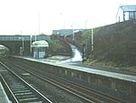
Hapton is a village and civil parish in the Borough of Burnley in Lancashire, England, 3 miles (4.8 km) west of Burnley, with a railway station on the East Lancashire Line. At the United Kingdom Census 2011, it had a population of 1,979.The parish adjoins the Burnley parishes of Dunnockshaw, Habergham Eaves and Padiham and Lowerhouse area of Burnley, the Hyndburn parish of Altham and Huncoat area of Accrington and the Loveclough area of Rossendale. The Leeds and Liverpool Canal and M65 motorway both pass through the village.
Excerpt from the Wikipedia article Hapton, Lancashire (License: CC BY-SA 3.0, Authors, Images).Hapton, Lancashire
Kirkside View,
Geographical coordinates (GPS) Address Nearby Places Show on map
Geographical coordinates (GPS)
| Latitude | Longitude |
|---|---|
| N 53.78 ° | E -2.315 ° |
Address
Kirkside View
Kirkside View
BB11 5RJ , Hapton
England, United Kingdom
Open on Google Maps


