Padiham
Civil parishes in LancashireDistricts in BurnleyEngvarB from May 2016History of LancashireIncomplete lists from June 2021 ... and 2 more
PadihamTowns in Lancashire

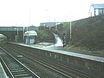
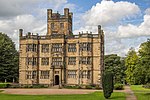
Padiham ( PAD-i-əm) is a town and civil parish on the River Calder, about three miles (5 km) west of Burnley, Lancashire, England. It forms part of the Borough of Burnley. Originally by the River Calder, it is edged by the foothills of Pendle Hill to the north-west and north-east. The United Kingdom Census 2011 gave a parish population of 10,098, estimated in 2019 at 10,138.
Excerpt from the Wikipedia article Padiham (License: CC BY-SA 3.0, Authors, Images).Padiham
Canning Street,
Geographical coordinates (GPS) Address Nearby Places Show on map
Geographical coordinates (GPS)
| Latitude | Longitude |
|---|---|
| N 53.797 ° | E -2.311 ° |
Address
Canning Street
Canning Street
BB12 7EG , Padiham
England, United Kingdom
Open on Google Maps


