place

Old Dam

Derbyshire geography stubsHamlets in DerbyshireHigh Peak, DerbyshireTowns and villages of the Peak District
Old Dam Lane geograph.org.uk 181278

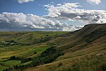
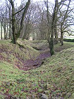
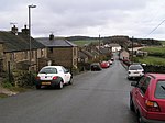
Old Dam is a hamlet in Derbyshire, England. It is located 3 miles (4.8 km) south-west of Castleton on the edge of the village of Peak Forest.

Excerpt from the Wikipedia article Old Dam (License: CC BY-SA 3.0, Authors, Images).

Old Dam
Old Dam, High Peak Peak Forest

Geographical coordinates (GPS) Address Nearby Places
placeShow on map

Wikipedia: Old DamContinue reading on Wikipedia

Geographical coordinates (GPS)

Latitude Longitude
N 53.314 ° E -1.829 °
placeShow on map

Address

Old Dam

Old Dam
SK17 8EW High Peak, Peak Forest
England, United Kingdom
mapOpen on Google Maps

Old Dam Lane geograph.org.uk 181278
Share experience

Nearby Places

Peak Forest
Peak Forest

Peak Forest is a small village and civil parish on the main road the (A623) from Chapel-en-le-Frith to Chesterfield in Derbyshire. The population of the civil parish at the 2011 census was 335.The village grew from the earlier settlement of Dam (still inhabited, with a number of houses and farms) at the conjunction of Perrydale and Damdale. There is an inn, a church and a primary school. Its name probably derives from the Forest of High Peak. The village is at the heart of the old royal forest and was formerly known as Chamber of Campana. The nearby Chamber Farm or Chamber Knoll may have been the exact location of the residence and meeting place of local forest officials.Its church is dedicated to 'Charles, King & Martyr' (King Charles I of England, executed in 1649). First erected in 1657, it was replaced in 1878 as a gift from the Duke of Devonshire. Until an Act of Parliament was passed in 1754 its minister was able to perform marriages without the need for reading the banns, and the village was known as the Gretna Green of Derbyshire.The Peak Forest Canal, although originally aiming for the limestone quarries in Great Rocks Dale just to the south of the village, never reached nearer than Buxworth, seven miles away, where it terminates at Bugsworth Basin. Instead, a horse-drawn tramway, the Peak Forest Tramway, was constructed in the late 18th century to connect the canal with the quarries between Dove Holes and Peak Forest. The original limestone-carrying purpose of the canal was replaced long ago by the Great Rocks mineral railway line serving the quarries around Buxton and joining the Manchester–Sheffield line, via the diverging Chapel Milton Viaduct over the Black Brook valley at Chapel Milton (between Chapel-en-le-Frith and Chinley). Its railway station (now closed) was built by the Midland Railway, two miles away at Small Dale. This was on its extension of the Manchester, Buxton, Matlock and Midlands Junction Railway, part of the main Midland Line from Manchester to London. It was also the northern junction for the line from Buxton. Stage 1 of the Peak District Boundary Walk runs from Buxton to Peak Forest.

Eldon Hill
Eldon Hill

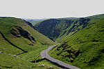
Eldon Hill is a hill in the Peak District National Park in the county of Derbyshire, England, 4 kilometres (2.5 mi) southwest of the village of Castleton. It is a 470-metre (1,540 ft) limestone hill whose pastureland is used for rough grazing, although a large proportion has been lost to limestone quarrying. It lies within the Castleton Site of Special Scientific Interest. Eldon Hill was formed when a bed of pure limestone was squeezed and upfolded by geological forces to form a dome; it is the highest limestone hill north of the River Wye.The hill is of considerable geological, historical and industrial interest; it lies at the northern limit of the carboniferous limestone in the Peak District, as further north it merges into the millstone grit of the Dark Peak. The name Elveden is first attested in 1285 as Elvedon and seems to have meant 'Elves' hill'.Quarrying permission was granted in 1950 and huge quantities of limestone have been excavated, mostly for road-building purposes. A large amount of the northern and northwestern slopes of the hill have disappeared and it has been called the best-known eyesore in the Peak District. In 1995 an application by RMC Aggregates to extend the quarrying further east was denied as parliament tightened up on environmental problems caused by old mineral permissions granted between 1948 and 1981. The quarry closed in 1999 and now stands unused with vegetation starting to grow on the quarry face. There have been some attempts at natural restoration with several aquatic pools being established in the former workings. The termination of quarrying has also given cavers the chance to explore some of the narrow caves exposed by the work, with Sidetrack Cave (discovered 2002) being one of the most impressive. In September 2020 the quarry was used as a film location for a TV series called Ray James, inspired by H. G. Wells' The War of the Worlds.350 metres south of the summit lies Eldon Hole. At 55 metres it is the deepest pothole in the area and was named as one of the Seven Wonders of the Peak by the philosopher Thomas Hobbes in 1636. According to folk tradition, it is the abode of the Devil. Close to the summit of the hill lies a Bronze Age tumulus, a large burial site measuring 16 by 15 metres and 1.5 metres high. The tumulus, a Scheduled Monument, has been excavated on several occasions with human skeletons and jewellery amongst the finds. The hill is dotted with numerous lead mines, all disused and many capped off for safety. Eldon Hill can be climbed either from the villages of Peak Forest to the south or Castleton to the north. The approach from Castleton goes up Cave Dale with a return down Winnats Pass to give a very interesting walk. The approach from Peak Forest is shorter and passes Eldon Hole on the way. The summit of the hill stands just 100 metres from the edge of the fenced quarry workings and gives good views with Mam Tor, Axe Edge Moor and the town of Buxton all well seen.

Hay Dale
Hay Dale

Hay Dale is a short dry valley near Buxton, Derbyshire, in the Peak District of England. It is part of a longer valley that runs for approximately 4 miles (6.4 km) north–south from Peak Forest (on the A623 road) to the River Wye at Millers Dale. This valley has several names along its length: from the northern end running downhill these are Dam Dale, Hay Dale, Peter Dale and Monk's Dale. There is a farmland plateau on either side.Hay Dale is part of the Derbyshire Dales National Nature Reserve. Natural England manages the reserve which covers five separate dales of the White Peak (Lathkill Dale, Cressbrook Dale, Hay Dale, Long Dale and Monk's Dale). The Carboniferous limestone rocks of the reserve were formed 350 million years ago from the shells and sediments of a tropical sea. The landscape was then sculpted by the ice sheets from the last Ice Age 20,000 years ago. The reserve contains ash woodland, limestone grassland and many wildflowers including early purple orchid, cowslip, common rock rose and thyme. Butterflies are abundant and include the brown argus. The Limestone Way and the Peak District Boundary Walk long-distance footpaths run along the length of the gentle valley floor. The Pennine Bridleway crosses the northern end of the dale, dividing it from Dam Dale. Where the Limestone Way crosses the A623 road about 1 mile (1.6 km) north of Hay Dale, the route of the old Batham Gate Roman road runs east–west.Access into Hay Dale from the north is via a footpath from Peak Forest through Dam Dale. From the south, the dale can be reached from the village of Wormhill along the Pennine Bridleway and through Peter Dale. A minor road running west from Wheston marks the southern end of Hay Dale and the start of Peter Dale.

Peter Dale (Derbyshire)

Peter Dale is a short dry crag-sided valley near Buxton, Derbyshire, in the Peak District of England. There is a farmland plateau on either side. The northern end of the valley leads into Hay Dale at Dale Head and the foot of the valley leads into Monk's Dale. Hay Dale and Monk's Dale are both part of the Derbyshire Dales National Nature Reserve managed by Natural England. The Carboniferous limestone rocks of all these dales were formed 350 million years ago from the shells and sediments of a tropical sea. The landscape was then sculpted by the ice sheets from the last Ice Age 20,000 years ago.The walking along the flat valley floor is easy except for a couple of short rock-strewn sections. The Limestone Way long-distance footpath runs along the length of the gentle valley floor. The Peak District Boundary Walk trail passes the northern end of the valley. The Pennine Bridleway runs across the southern end and then parallel to the dale about 1km to the east (through the hamlet of Wheston). Where the Limestone Way crosses the A623 road (about 1 km north of Hay Dale), the route of the old Batham Gate Roman road runs east–west.Peter Dale's limestone cliffs are well-suited to rock climbing, with 25 graded routes on Main Crag.Access into Peter Dale from the south can be made from the hamlet of Wormhill along the Pennine Bridleway. From the north there is a footpath from the village of Peak Forest (on the A623 road) through Dam Dale and Hay Dale.