IJmeer
AlmereFlevoland geography stubsGeography of AmsterdamGeography of Gooise MerenLakes of the Netherlands ... and 5 more
Landforms of FlevolandLandforms of North HollandNorth Holland geography stubsRamsar sites in the NetherlandsWaterland

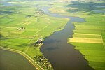
The IJmeer is a 'bordering lake' (Randmeer) in the Netherlands. It lies between the De Nes polder (in Waterland), Pampushaven, Hollandse Brug and the mouth of the IJ in IJburg, straddling the provinces of North Holland and Flevoland. It is an important habitat for birds such as the tufted duck and scaup. To the north-east is the Markermeer, south-east is the Gooimeer.
Excerpt from the Wikipedia article IJmeer (License: CC BY-SA 3.0, Authors, Images).IJmeer
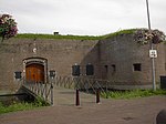
Fortwoning Pampus, Gooise Meren
Geographical coordinates (GPS) Address Nearby Places Show on map
Geographical coordinates (GPS)
| Latitude | Longitude |
|---|---|
| N 52.366666666667 ° | E 5.0666666666667 ° |
Address
Fort Pampus
Fortwoning Pampus
1398 PX Gooise Meren
North Holland, Netherlands
Open on Google Maps


