Jong Batu
Islands of BruneiRiver islands of AsiaUninhabited islands

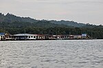
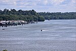
Jong Batu is a rock outcrop located in the Brunei River. It is shaped such that when viewed from the shores of the Brunei River, it resembles a sinking ship, with the bow sticking out of the water. In Brunei folklore, the legend of Nakhoda Manis (literally the "Captain Sweet" in Malay) tells of how an unfilial son was turned to the rock outcropping known as Jong Batu.
Excerpt from the Wikipedia article Jong Batu (License: CC BY-SA 3.0, Authors, Images).Jong Batu
Geographical coordinates (GPS) Address Nearby Places Show on map
 Continue reading on Wikipedia
 Geographical coordinates (GPS)
| Latitude | Longitude |
|---|---|
| N 4.8662817 ° | E 114.9255304 ° |
Address
BA2112
Brunei
Open on Google Maps