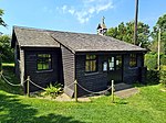
Ringstead Bay

Ringstead Bay, with the small village of Ringstead at the eastern end and the prominent headland of White Nothe at the western end, is located on the coast in Dorset, southern England. The area lies on the Jurassic Coast and is known for its natural environment and fossils.Ringstead Bay has a pebble and shingle beach with some sand. There are offshore reefs approximately 0.6 kilometres (0.37 mi) in length at the western end opposite the village that are uncovered at low tide. This forms is intertidal zone between the low cliffs to the north and the English Channel to the south. The Ringstead Coral Bed a geological formation exposed at Ringstead Bay, hence the name. It preserves fossils dating back to the Jurassic period. Immediately to the east are the white chalk cliffs of White Nothe, dominating the bay. Below is Burning Cliff. It is possible to walk to the top of White Nothe and back, with views of the bay and across to the Isle of Portland. It is also possible to walk to Ringstead Bay on a circular walk from Lulworth Cove to the east, via Durdle Door and White Nothe.Ringstead Bay also has a nudist beach that is a 20-minutes walk east of the main Ringstead beach.
Excerpt from the Wikipedia article Ringstead Bay (License: CC BY-SA 3.0, Authors, Images).Ringstead Bay
Smugglers Path,
Geographical coordinates (GPS) Address Nearby Places Show on map
Geographical coordinates (GPS)
| Latitude | Longitude |
|---|---|
| N 50.6309 ° | E -2.3378 ° |
Address
Smugglers Path
DT2 8NJ , Owermoigne
England, United Kingdom
Open on Google Maps


