place

Waterford, Rhode Island

Blackstone, MassachusettsRhode Island geography stubsUse mdy dates from July 2023Villages in MassachusettsVillages in Providence County, Rhode Island
Villages in Rhode IslandVillages in Worcester County, Massachusetts
Waterford Rhode Island

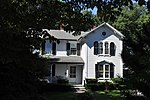
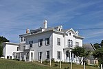
Waterford is a village located on and around St. Paul Street in North Smithfield, Rhode Island and Blackstone, Massachusetts. The Blackstone River and Branch River converge just south of the village. Waterford was developed in 1824 by Welcome Farnum, a Yankee entrepreneur, who purchased land, built a dam on the Branch River, and constructed the first textile mill called Red Mill. He named the village Waterford because many of the Irish workers in his mill came from Waterford, Ireland. The last mills in the area were constructed mid-nineteenth century. Waterford is home to St. Paul's Church (1851), originally served a largely Irish population, and sits on the Rhode Island/Massachusetts border. Adjacent to the church is the church school and many businesses.

Excerpt from the Wikipedia article Waterford, Rhode Island (License: CC BY-SA 3.0, Authors, Images).

Waterford, Rhode Island
Fountain Street,

Geographical coordinates (GPS) Address Nearby Places
placeShow on map

Wikipedia: Waterford, Rhode IslandContinue reading on Wikipedia

Geographical coordinates (GPS)

Latitude Longitude
N 42.0125 ° E -71.538333333333 °
placeShow on map

Address

Fountain Street 78
02896
Rhode Island, United States
mapOpen on Google Maps

Waterford Rhode Island
Share experience

Nearby Places

Blackstone Viaduct
Blackstone Viaduct

The Blackstone Viaduct, or the New York & New England Railroad Viaduct is a historic viaduct in Blackstone, Massachusetts. The viaduct was built in 1872 by the Boston, Hartford and Erie Railroad and the American Bridge Company. The viaduct is 1,600 feet (490 m) long structure, consisting of masonry arches and earthen embankments in the Massachusetts portion of the village of Waterford. It runs from the Blackstone River in the east to a still-watered section of the defunct Blackstone Canal to the west. The most prominent portion of the structure is an 800-foot earthen embankment running west from the river that is 25 feet (7.6 m) high, and then a 375-foot (114 m) multiple-arch masonry bridge constructed out of granite which was sheathed in concrete in 1918. The structure was listed on the National Register of Historic Places in 2002.The viaduct was built as part of a project by the Boston, Hartford and Erie (BH&E) to build a complete run between New York City and Boston. The first leg of this route, between Blackstone and Boston, was opened in 1849, and was purchased by the BH&E in 1867. That company completed the connection between Blackstone and New Haven, Connecticut in 1873, part of which included construction of this viaduct, replacing an older wooden trestle. By the early 20th century, some of the viaduct's arches were in deteriorating condition, and were reinforced with concrete in 1918. The bridge over Canal Street was replaced in 1917. The viaduct is one of the largest of the state's 19th-century masonry bridge structures, second in size only to the Canton Viaduct.In the late 1960s, floodwaters washed away an abutment of the adjoining trestle to the east, ending service over the viaduct.The first phase of a restoration project intended to convert the viaduct into a recreational facility including a bike path began in 2019. The bike path will travel over the viaduct and connect two disjointed sections of the Blackstone River Greenway, one 3.7-mile segment in Massachusetts terminating in the town of Blackstone, and a 0.6-mile stretch in Woonsocket, Rhode Island. As of 2021, the Greenway comprised a total of 17 miles of off-road bike path, along a planned 48-mile route between Providence and Worcester.