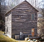
Warrensville, North Carolina
Unincorporated communities in Ashe County, North CarolinaUnincorporated communities in North CarolinaUse mdy dates from July 2023Western North Carolina geography stubs
Warrensville (formerly known as Buffalo Creek) is an unincorporated community at the intersection of North Carolina Highways 88 and 194 in Ashe County, North Carolina, United States, east of Comet. It lies at an elevation of 2,707 feet (825 m). The ZIP Code for Warrensville is 28693.
Excerpt from the Wikipedia article Warrensville, North Carolina (License: CC BY-SA 3.0, Authors).Warrensville, North Carolina
NC 88;NC 194,
Geographical coordinates (GPS) Address Nearby Places Show on map
Geographical coordinates (GPS)
| Latitude | Longitude |
|---|---|
| N 36.460555555556 ° | E -81.518888888889 ° |
Address
NC 88;NC 194 5196
28693
North Carolina, United States
Open on Google Maps


