Haverthwaite
Civil parishes in CumbriaFurnessSouth Lakeland DistrictUse British English from September 2019Villages in Cumbria

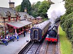
Haverthwaite is a small village and civil parish in the Furness region of Cumbria, England. It is also within the boundaries of the Lake District National Park. It is located several miles east of Ulverston and is near the southern end of Windermere. In the 2001 census the parish had a population of 728, increasing at the 2011 census to 797.The village gets part of its name from the Old Norse word thwaite which usually refers to a clearing or settlement in the forest.
Excerpt from the Wikipedia article Haverthwaite (License: CC BY-SA 3.0, Authors, Images).Haverthwaite
B5278,
Geographical coordinates (GPS) Address Nearby Places Show on map
Geographical coordinates (GPS)
| Latitude | Longitude |
|---|---|
| N 54.243 ° | E -3.005 ° |
Address
B5278
LA12 8LY , Haverthwaite
England, United Kingdom
Open on Google Maps


