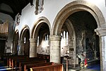
Hodthorpe
Bolsover DistrictDerbyshire geography stubsSherwood ForestVillages in Derbyshire

Hodthorpe is an urban village in the parish of Hodthorpe and Belph, Bolsover, Derbyshire, lying close to the Nottinghamshire border and on the edge of Sherwood Forest. The village has two principal streets, Queens Road (the main road running through the village) and Kings Street. It has one shop, a village primary school, and a Working Men's club. There are two parks. The heritage site of Creswell Crags, famous for its prehistoric cave art, lies close to the village.
Excerpt from the Wikipedia article Hodthorpe (License: CC BY-SA 3.0, Authors, Images).Hodthorpe
Broad Lane,
Geographical coordinates (GPS) Address Nearby Places Show on map
Geographical coordinates (GPS)
| Latitude | Longitude |
|---|---|
| N 53.283333333333 ° | E -1.1833333333333 ° |
Address
Broad Lane
Broad Lane
S80 4XF , Hodthorpe and Belph
England, United Kingdom
Open on Google Maps


