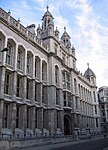
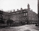
Fetter Lane
A4 road (England)Streets in the City of LondonUse British English from December 2016

Fetter Lane is a street in the ward of Farringdon Without in the City of London. It forms part of the A4 road and runs between Fleet Street at its southern end and New Fetter Lane, which continues north towards Holborn Circus.
Excerpt from the Wikipedia article Fetter Lane (License: CC BY-SA 3.0, Authors, Images).Fetter Lane
Fetter Lane, City of London
Geographical coordinates (GPS) Address Nearby Places Show on map
Geographical coordinates (GPS)
| Latitude | Longitude |
|---|---|
| N 51.515 ° | E -0.1096 ° |
Address
Fetter Lane 10
EC4Y 1BN City of London
England, United Kingdom
Open on Google Maps


