place

Holbeck, Nottinghamshire

Bassetlaw DistrictFormer civil parishes in NottinghamshireNottinghamshire geography stubsUse British English from May 2016Villages in Nottinghamshire
Chapel of St Winifred, Holbeck geograph.org.uk 1168784

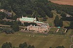
Holbeck is a village and former civil parish, now in the parish of Norton, Cuckney, Holbeck and Welbeck, in the Bassetlaw district, in the county of Nottinghamshire, England. It is located 6 miles south-west of Worksop. According to the 2001 census it the parish a population of 449, reducing to 195 (including Holbeck Woodhouse and Welbeck) at the 2011 Census. It is an estate village built for the Dukes of Portland at Welbeck Abbey.

Excerpt from the Wikipedia article Holbeck, Nottinghamshire (License: CC BY-SA 3.0, Authors, Images).

Holbeck, Nottinghamshire
Bassetlaw Norton, Cuckney, Holbeck and Welbeck

Geographical coordinates (GPS) Address Nearby Places
placeShow on map

Wikipedia: Holbeck, NottinghamshireContinue reading on Wikipedia

Geographical coordinates (GPS)

Latitude Longitude
N 53.25 ° E -1.18 °
placeShow on map

Address


S80 3NQ Bassetlaw, Norton, Cuckney, Holbeck and Welbeck
England, United Kingdom
mapOpen on Google Maps

Chapel of St Winifred, Holbeck geograph.org.uk 1168784
Share experience

Nearby Places

Creswell Crags
Creswell Crags

Creswell Crags is an enclosed limestone gorge on the border between Derbyshire and Nottinghamshire, England, near the villages of Creswell and Whitwell. The cliffs in the ravine contain several caves that were occupied during the last ice age, between around 43,000 and 10,000 years ago. Its caves contain the northernmost cave art in Europe. The evidence of occupation found in the rich series of sediments that accumulated over many thousands of years is regarded as internationally unique in demonstrating how prehistoric people managed to live at the extreme northernmost limits of their territory during the Late Pleistocene period.The caves contain occupation layers with evidence of flint tools from the Mousterian, proto-Solutrean, Creswellian and Maglemosian cultures. They were seasonally occupied by nomadic groups of people during the Upper Palaeolithic and Mesolithic periods. Evidence of Neolithic, Bronze Age, Roman and post-medieval activity has also been found there. There is evidence of Neanderthal occupation 50,000–60,000 years ago, a brief Gravettian occupation around 32,000 years ago and use of all the main caves during the Magdalenian around 14,000 years ago. The site is open to the public and has a visitor centre with a small museum of objects associated with the caves, including a stuffed cave hyena. As a result of its unique features, Creswell Crags has been designated as a Site of Special Scientific Interest (SSSI). It has also been put forward as a potential World Heritage Site. In 2005–06, the B6042 road was re-routed from its path through the gorge, by approximately 150 metres (160 yd) to the north, to minimise traffic impact on the site.

Whaley Thorns
Whaley Thorns

Whaley Thorns is a former colliery village in the Bolsover district of Derbyshire, England, close to the Nottinghamshire border. Whaley Thorns lies just north of Nether Langwith and Langwith, 1.5 miles (2.4 km) south-east of Creswell, and west of Cuckney. It is in the civil parish of Scarcliffe. The village takes its name from a dense wood, recorded on the first Ordnance Survey Maps. "Whaley" being Celtic for water/spring, referring to both the local springs, just to the north, and the river Poulter which lies only 200 yards (180 m) to the south. And "Thorn" an Anglo-Saxon word, for wood. So the original meaning, may have been either "Wood of the Springs", or "Wood above/between the water(s)". In the Mid-nineteenth century, much of the wood was cut down, following the discovery of coal beneath it. Thanks to the nearby railway, the site soon grew into a colliery village. The village acquired both a fine Anglican Chapel, and a Methodist Chapel; both still hold regular services. It also acquired a large primary school, and later on in the 1940s, a fine Frank Lloyd Wright style school too. In the late 1970s the chief employer, the colliery, closed. Since the colliery closures, the first school has closed and re-opened as a heritage centre, as well as re-education centre for ex-miners. The Second has remained open as a primary school. Following the Pit (Colliery) closure, the villages' population has greatly reduced, due to the, lack of local employment, and the deprivation that happened as a result. Since 1990, many rows of terraced houses, have been demolished, due to their run-down, or in some cases derelict, nature. There are now just two shops, and one pub.