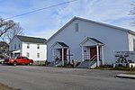
Twelve O'clock Knob

Twelve O'clock Knob is a mountain located in southwestern Roanoke County, Virginia, directly south of Salem, Virginia. According to local lore, enslaved people in the western Roanoke Valley noted that the Sun was directly over the mountain roughly around noon local time. In 1995 and 1996, the Tour DuPont staged a time trial in the Roanoke Valley, the highlight of which was a ride over the steep, winding Twelve O'clock Knob Road. The north slope of the ridgeline formed by Poor Mountain, Twelve O'clock Knob and adjacent peaks such as Sugarloaf Mountain mark the southwestern boundary of the Roanoke Valley. This mountain should not be confused with Twelve O'Clock Knob in Patrick County, Virginia.
Excerpt from the Wikipedia article Twelve O'clock Knob (License: CC BY-SA 3.0, Authors, Images).Twelve O'clock Knob
Twelve Oclock Knob Road,
Geographical coordinates (GPS) Address Nearby Places Show on map
Geographical coordinates (GPS)
| Latitude | Longitude |
|---|---|
| N 37.248555555556 ° | E -80.084455555556 ° |
Address
Twelve Oclock Knob Road
Twelve Oclock Knob Road
24018
Virginia, United States
Open on Google Maps


