Cardinia Creek
Melbourne Water catchmentMelbourne geography stubsRivers of Greater Melbourne (region)Victoria (state) river stubs

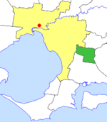
The Cardinia Creek is a freshwater stream southeast of Melbourne, Victoria, Australia, that flows from the Cardinia Reservoir in the Dandenong Ranges into the Western Port Bay between Tooradin and Koo Wee Rup. The creek forms majority of the boundary between the local government areas of the City of Casey and the Shire of Cardinia. It runs through the town of Beaconsfield and is home to much native flora and fauna.
Excerpt from the Wikipedia article Cardinia Creek (License: CC BY-SA 3.0, Authors, Images).Cardinia Creek
Princes Freeway, Melbourne Berwick
Geographical coordinates (GPS) Address Nearby Places Show on map
Geographical coordinates (GPS)
| Latitude | Longitude |
|---|---|
| N -38.065555555556 ° | E 145.37805555556 ° |
Address
Princes Freeway
Princes Freeway
3806 Melbourne, Berwick
Victoria, Australia
Open on Google Maps


